

Latest Weather Blog
Tuesday PM Forecast: light rain moving toward the Capital Area
Cloud cover will continue to thicken on Tuesday night. By Wednesday morning, enough moisture will be present to see showers across southern Louisiana. Expect off and on showers through the day. Rain chances taper off to close the workweek, with another cold front sending temperatures plummeting for the weekend.
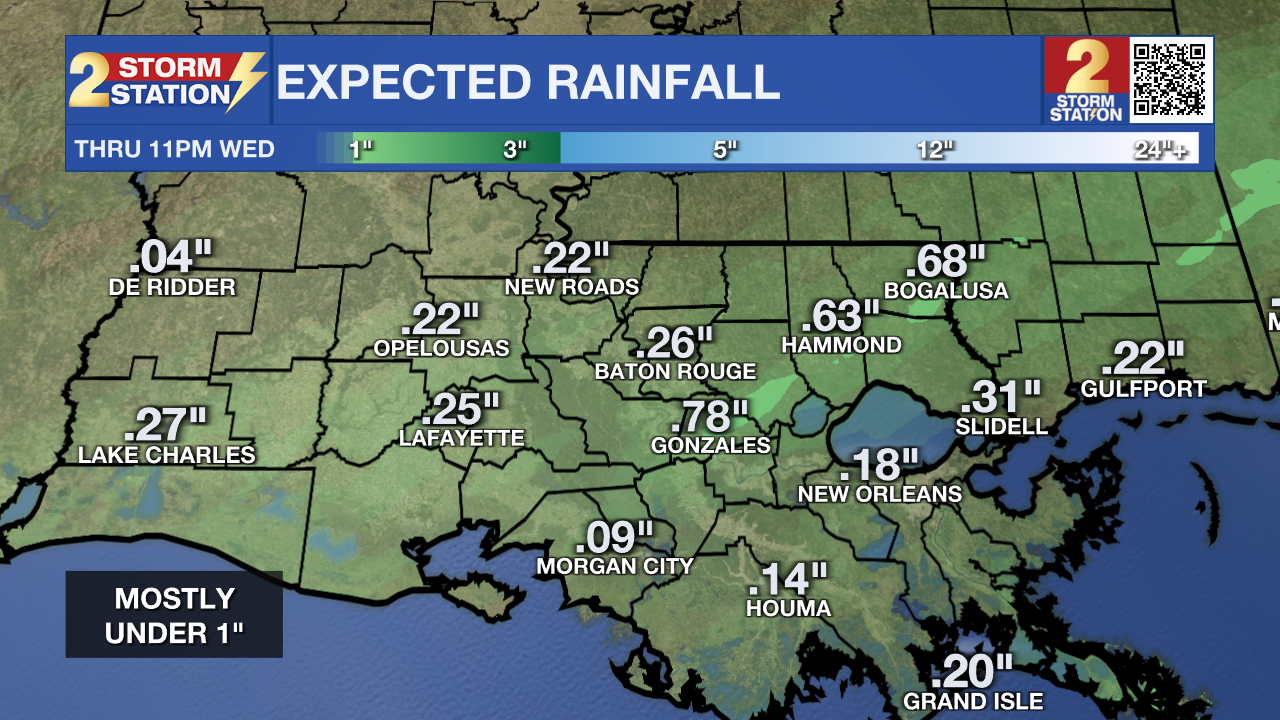
Tonight & Tomorrow: Low temperatures will settle in the mid 60s as clouds will progressively lower on Tuesday night. We’ll wake up to an overcast sky on Wednesday with showers beginning to move into our southern parishes in the hours leading up to sunrise. Rain coverage will increase through Wednesday morning, perhaps affecting the morning commute. Periods of rain will continue into the afternoon. The wind will kicks up also, with northeast breezes of 10-15mph and gusts up to 30mph possible. Afternoon temperatures will be closely tied to any rainfall. Should a soggier solution pan out, temperatures will struggle to reach 70°. However, temperatures might try to recover into the 70s during drier periods. Unfortunately, this does not look like a drought-busting rain event. Most are looking at totals under 1”, with higher amounts closer to the coast.
Up Next: The rain coverage backs off considerably on Thursday and Friday with a 10-20% chance of rain each of those days. Aside from the small rain chance, we’ll otherwise be dry to close out the workweek with highs climbing back into the 80s. Another cold front is set to arrive sometime Friday night. This will send both temperatures and humidity dropping into the weekend. This upcoming weekend will feel very similar to last weekend. We also expect the comfortable weekend weather to persist into next week.
Trending News
Get the latest 7-day forecast and real time weather updates HERE.
Watch live news HERE.
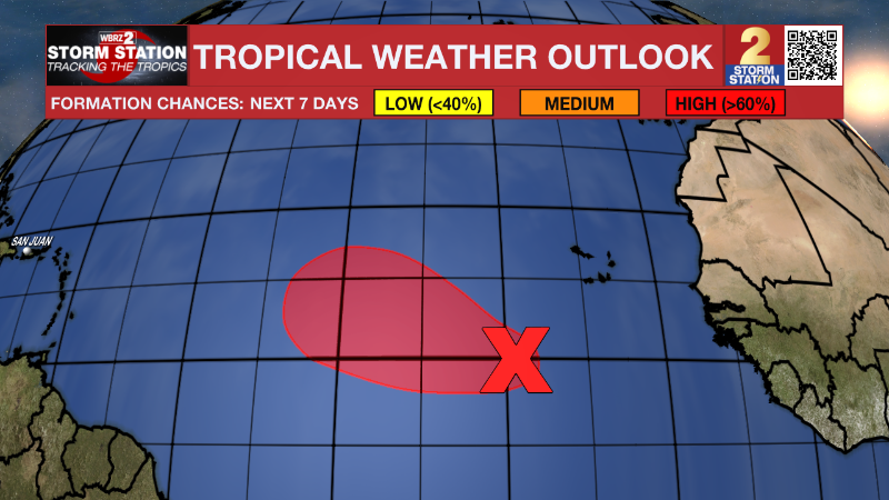
The Tropics: We are still tracking a tropical wave located several hundred miles southwest of the Cabo Verde Islands. The system continues to organize and has an 80% chance of developing into a tropical depression in the next couple of days. The storm is generally moving northwest across the eastern and central tropical Atlantic.
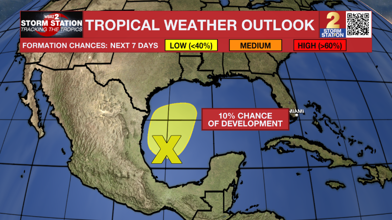
We’re also watching an area of low pressure in the southwest Gulf of Mexico. This system has not shown many signs of tropical organization recently. It appears unlikely that the system will acquire tropical characteristics before merging with a front that affects our weather locally on Wednesday. Although the system is moving north toward the U.S. Gulf Coast, our forecast for Wednesday of gusty winds and showers remains unchanged regardless of any tropical development.
-- Meteorologist Malcolm Byron
The Storm Station is here for you, on every platform. Your weather updates can be found on News 2, wbrz.com, and the WBRZ WX App on your Apple or Android device. Follow WBRZ Weather on Facebook and Twitter for even more weather updates while you are on the go.
More News
