

Latest Weather Blog
Thursday AM Forecast: One More Low Humidity Afternoon, Moisture Returns
Relatively pleasant conditions will remain in place through at least Thursday. Forecast focus moves to returning humidity and a tropical wave which could deliver some showers next week.
Thursday, an upper-level ridge of high pressure will build west of Louisiana, reducing low-level mixing. Furthermore, mostly sunny and hot conditions will promote ozone formation, and light winds will recirculate smoke from regional fires into the state, enhancing ozone production. Thus, Air Quality Index levels will be Unhealthy for Sensitive Groups in the Baton Rouge Metro Area.
The Air Quality Index indicates that ozone will be at the orange level, which is Unhealthy for Sensitive Groups. Increasing ozone levels may cause unhealthy air quality during afternoon hours. Active children and adults, the elderly and people with respiratory diseases, such as asthma, should avoid prolonged outdoor activities and exertion.
Area residents are encouraged to take one or more of the following voluntary actions to help reduce the formation of ozone:
-Drive less. Carpool, walk and bike, combine errands and care for your car. Be sure your gas cap is on tight.
-Refuel your vehicle, mow grass and use gas powered lawn equipment and off road vehicles after 6 p.m.
-Postpone chores that use oil based paint, varnishes and solvents that produce flame.
Trending News
-If you barbecue, use an electric starter instead of starter fluid.
-Take your lunch to work or walk to lunch.
-Conserve energy in your home.
Today & Tonight: Thursday will be a duplicate of sunshine, warm temperatures and low humidity. High temperatures will top out near 98 degrees. Overnight will be clear and quiet. Low temperatures will stay close to average, though not as cool and this morning, in the mid 70s.
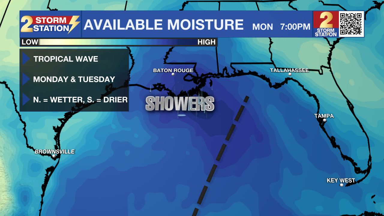
Up Next: By Friday afternoon, some moisture will start to creep into the atmosphere again. Over the weekend, lows will return to the upper 70s and low 80s and highs will be pushing through the century mark. This will likely necessitate the need for heat alerts once again. By Monday, a fast moving tropical wave will send a plume of moisture from east to west across the Gulf of Mexico. Depending on the exact track of this pocket of moisture, there may be an uptick in showers and thunderstorms early in the week, especially for coastal areas. However, the big heat dome that we have been dealing with all summer, will remain stubbornly in place just north of the area, and will try to fight the wave further south. While there is a low chance of some development, this system is unlikely to get well organized or pose a big threat to the area.
Get the latest 7-day forecast and real time weather updates HERE.
Watch live news HERE.
The Tropics: A broad area of low pressure could form in the central or western Gulf of Mexico by the beginning of next week. There is a twenty percent chance of some slow development of this system as it moves westward and approaches the western Gulf of Mexico coastline by the middle of next week.
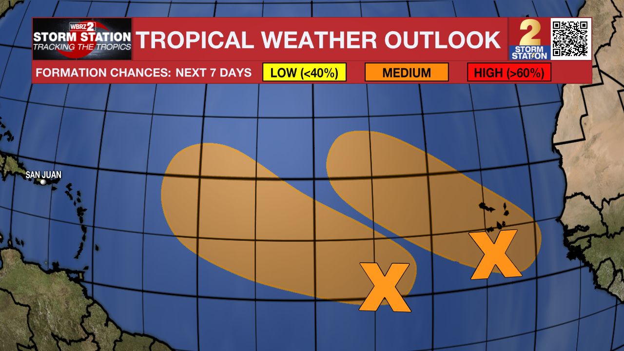
Disorganized showers and thunderstorms located over the central tropical Atlantic are associated with an elongated trough of low pressure centered about 750 miles west-southwest of the Cabo Verde Islands. Environmental conditions appear conducive for gradual development of this system, and there is a fifty percent chance that a tropical depression could form during the next several days while moving toward the west or west-northwest at about 10 mph across the central tropical Atlantic.
A tropical wave near the Cabo Verde Islands is producing a large area of disorganized showers and thunderstorms. This system is forecast to move toward the west-northwest at about 15 mph, with an area of low pressure expected to form in a day or so just to the west of the Cabo Verde Islands. There is a forty percent chance of further development of the low, and a tropical depression could form over the weekend before environmental conditions become unfavorable early next week.
--Keller
The Storm Station is here for you, on every platform. Your weather updates can be found on News 2, wbrz.com, and the WBRZ WX App on your Apple or Android device. Follow WBRZ Weather on Facebook and Twitter for even more weather updates while you are on the go.
More News
