

Latest Weather Blog
More than halfway home on the heat
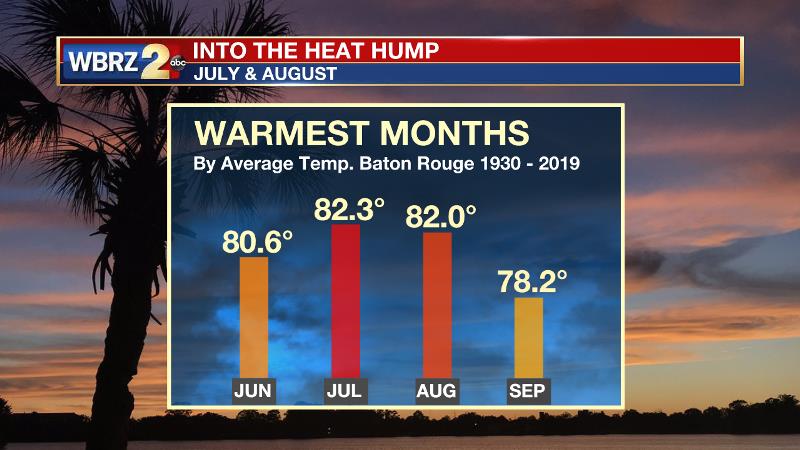
Statistically and historically, the Baton Rouge area has reached an important milestone on the high summer heat to which we are so accustomed. The transition from July to August marks the halfway point between the two hottest months in an average year. Using average as a benchmark, the automated surface observation station at Metro Airport has registered 53 days at 90 degrees or above while the historical average (since 1930) is for that mark to be met 90 times per year. Aside from the 90s, temperatures since the start of climatological summer (June 1) have been near average. Another date to keep in mind is October 1—which is the historical average for the last time thermometers hit 90 degrees for the year. The latest 90 degree reading ever registered in Baton Rouge was on October 26, 1939.
Of course, weather follows no rules nor does it always work out to average. Also, we know in the south that as the back half of summer approaches, there is more to pay attention to than just hot temperatures. Now is the time when the tropics traditionally become more active and this season is already setting records.
Trending News
The WBRZ Weather Team is here for you, on every platform. Your weather updates can be found on News 2, wbrz.com, and the WBRZ WX App on your Apple or Android device. Follow WBRZ Weather on Facebook and Twitter for even more weather updates while you are on the go.
More News
