

Latest Weather Blog
Thursday PM Forecast: Next cold front brings chance of showers, possibly flurries
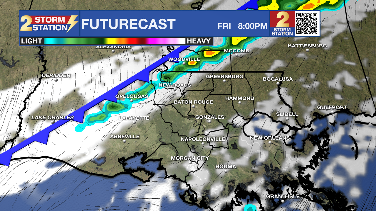
Despite a brief moderation on Friday, a reinforcing cold front will drive temperatures lower into the weekend. A few showers may accompany the front, with even the potential for something frozen later in the weekend.
Tonight & Tomorrow: With clear skies and generally light winds, the cold will settle in even more by Friday morning. A few areas along and north of the major highways will flirt with the freezing mark, but even in areas that don’t, lows in the mid-30s will still be supportive of frost. Keep the heavier coats out and consider waking up a few minutes earlier to defrost the windshield. Sunshine and a returning southerly breeze will nudge temperatures in a warmer direction on Friday, with highs reaching the upper 60s by afternoon. Late in the day, high clouds will start spilling into the area. Those will increase through the evening ahead of a cold front. Isolated showers will be possible along it, so a precautionary raincoat will be a good idea for Friday night plans.
Up Next: The weekend will begin with a mixture of clouds and sun following Friday night’s front. Temperatures will drop in its wake, with highs in the 50s on both weekend days. Meanwhile, lows appear to dip below freezing by daybreak Sunday. Specifically, overnight between Saturday and Sunday, there are signs of increasing clouds as an upper disturbance swings through. Should there be enough moisture, light showers and/or a few flurries cannot be ruled out.
Snow Chance: Data is becoming less optimistic for seeing a few snowflakes on Saturday night. That said, it’s still far from a slam-dunk signal. As cold air continues spilling into the region, a piece of upper-level energy will draw a touch of moisture inland. If enough moisture is present, light rain or even snow flurries/showers could fall Saturday night. If any frozen precipitation does occur, no impacts are expected. Skies will quickly clear after dawn on Sunday with a bright and chilly finish to the weekend.

MLK Day & Beyond: Martin Luther King Jr. Day will feature plenty of sunshine with temperatures topping out near 60° in the afternoon. Clouds will increase as midweek approaches, with rain likely returning by Wednesday or Thursday.
Trending News
Get the latest 7-day forecast and real-time weather updates HERE.
Watch live news HERE.
— Meteorologist Malcolm Byron
The Storm Station is here for you, on every platform. Your weather updates can be found on News 2, wbrz.com, and the WBRZ WX App on your Apple or Android device. Follow WBRZ Weather on Facebook and X for even more weather updates while you are on the go.
More News
