

Latest Weather Blog
Wednesday AM forecast: Better chances for showers. Staying warm.
Unseasonably warm and increasingly humid air remains in place across South Louisiana. While most areas stay dry on Wednesday, a brief isolated afternoon shower or thunderstorm cannot be ruled out as we move into the middle of the week.

Today and tonight: Warm, humid air continues to stream into Baton Rouge and surrounding parishes on southeast winds. After early morning low clouds and areas of fog, skies turn partly sunny with afternoon highs climbing into the upper 70s to lower 80s.

Use the slider to advance through the next 24 hours of Futurecast
Trending News
With daytime heating and increasing moisture, an isolated pop-up shower or thunderstorm may develop during the afternoon hours. Coverage will be limited, and most neighborhoods will remain dry, but any storm that forms could produce lightning and a brief downpour. Tonight will be mild with lows only falling into the low to mid 60s. Some fog development is possible again late tonight into early Thursday, especially near the rivers and lakes.
Up Next: The warm pattern holds through the rest of the week with highs reaching the low to mid 80s by Friday and into the weekend, running 10 to 15 degrees above normal for early March.
Isolated to scattered afternoon showers and thunderstorms become more likely Thursday and Friday during peak heating hours. Rain coverage still does not look widespread, but lightning and brief heavy rain will be the primary concerns with any storms that develop. Nightly fog remains possible through early next week as humid onshore flow continues.
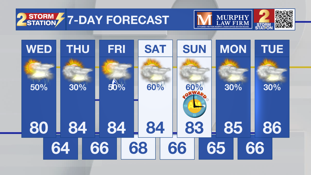
What to look out for: Isolated afternoon showers and thunderstorms through the end of the week, mainly during peak heating hours. Increasing confidence that a more active pattern could develop late this weekend into early next week as a nearby frontal boundary and stronger upper-level dynamics approach. While details are still uncertain, this setup bears watching for the potential of heavier rain and more widespread storm coverage early next week.
LSU Sports: LSU Baseball will be on the road in Lafayette for a big in-state matchup against UL-Lafayette with first pitch at 6 p.m. Scattered afternoon showers or thunderstorms may still be ongoing earlier in the day, but activity should begin to taper off around game time, with temperatures in the upper 70s, falling into the lower 70s later in the evening. Players and fans should be prepared for humid conditions, and while most storms should be winding down, a brief delay can’t be completely ruled out.
Get the latest 7-day forecast and real-time weather updates HERE.
Watch live news HERE.
– Dave
The Storm Station is here for you, on every platform. Your weather updates can be found on News 2, wbrz.com, and the WBRZ WX App on your Apple or Android device. Follow WBRZ Weather on Facebook and X for even more weather updates while you are on the go.
More News
