

Latest Weather Blog
Your warming December weather
The big weather story as the week ends will be unseasonable warmth. Highs will approach 80 on Friday and Saturday.
THE FORECAST:
Today and Tonight: Again, morning fog will give way to some afternoon sunshine. High temperatures will be well into the 70s with light southerly winds. During the overnight hours, clear skies early will give way to a layer of fog by morning with lows in the mid 50s.
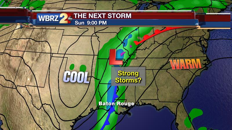
Looking Ahead: Thursday will repeat an ongoing pattern of morning fog, afternoon sun and warmer highs. By Friday, winds will pick up enough that fog should be limited and morning lows will be held in the 60s. Expect mostly sunny skies, south winds around 15mph and highs in the upper 70s. By Saturday, clouds will increase as winds continue. Some locations may make it to 80 in the afternoon. Showers and thunderstorms will accompany a cold front into the area on Sunday.
Trending News
THE SCIENCE:
Forecast Discussion: High pressure is shifting to the East Coast of the United States. As this occurs, winds are taking on a southerly component and injecting moisture and warmth into the local air mass. Results include thick morning fog, as temperatures and dew points meet up, and afternoon highs that will run well above average. By Friday, a trough digging into the Southwest United States will induce Lee cyclogenesis over the Rocky Mountain West and a developing surface low will clash with the stubborn eastern surface high to create a modest pressure gradient. Southerly winds will increase over the Gulf South on Friday and Saturday aiding even more warming. Temperatures by this time will be a good 10-15° above average. The stronger winds will disrupt further fog formation Friday and Saturday though. The trough and surface low will move to the Great Lakes region between Saturday and Monday pulling a cold front across the region. This front is shown by both major global forecast models to have an ongoing squall line. We will need to monitor this line for heavy rain and gusty winds, but right now there are not too many alarms for a widespread severe weather event.
--Josh
Stay connected with me… share your thoughts!
Twitter: @Josh_Eachus
Google+: Josh Eachus
Facebook: Meteorologist Josh Eachus
More News
