

Latest Weather Blog
Wednesday evening forecast: trading widespread showers for steam
What a difference 24 hours can make! The local area is getting a chance to dry out and will enter a more normal summer pattern for the foreseeable future.
Next 24 Hours: While a few rogue showers are possible through 10pm this evening, the rest of the night will be partly cloudy and quiet. Low temperatures will settle in the mid 70s. Some early sunshine will heat things up on Thursday before the standard summer fare of “PM Pop-Ups” arrives during the afternoon. Just about 30 percent of the 13 Parish, 3 County Forecast Area will see rain on Thursday. It will taper after dusk. High temperatures should have no trouble reaching the low 90s.
Up Next: Friday is expected to be the driest day of the forecast period. Very little rain will develop over the area leading to high temperatures ranging from 93 to 95 degrees. Plenty of late July humidity will mean the afternoon hours will have feels-like temperatures in the low 100s. If you have outdoor plans this weekend, it is back to the typical summer routine. While nobody will be washed out, isolated thunderstorms could chase a few indoors during the afternoon hours. Always take shelter inside if you can hear thunder or have lightning within five miles of your location. This status quo pattern will carry into next week. CLICK HERE for your full 7-Day Forecast.
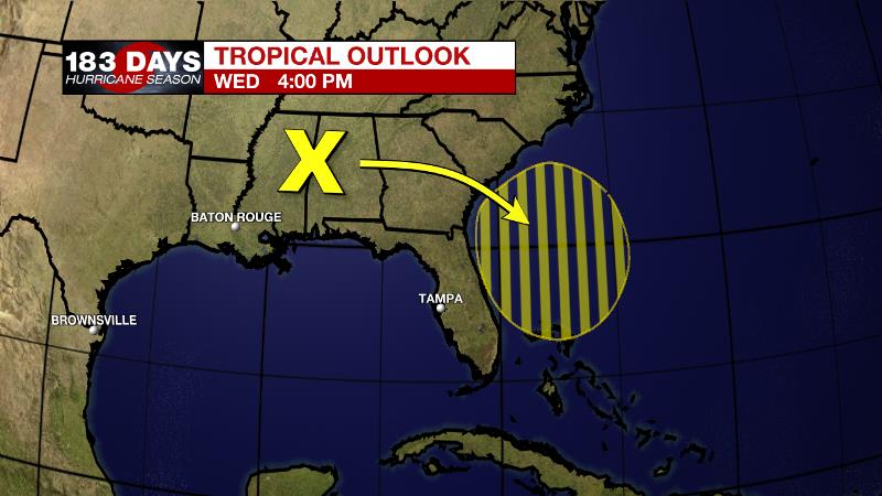
The Tropics: A broad trough of low pressure associated with a decaying frontal boundary over Mississippi and Alabama is forecast to move offshore of the southeastern United States coastline by the end of this week. Environmental conditions are forecast to be marginally conducive and there is a 20 percent chance for development into early next week while the system meanders offshore of the coasts of South Carolina, Georgia, and northeastern Florida. For the latest tropical forecasts and information, visit the WBRZ Hurricane Center as we navigate all 183 Days of Hurricane Season.
Trending News
The Explanation: A weak front will dissipate across the I-20 corridor over the next 24 hours as an upper level trough over western Louisiana and eastern Texas is absorbed by the jet stream. An upper level ridge will take the place of these features increase subsidence (sinking air) and leading to a mainly dry, hot day to end the week. Just ahead of this ridge, daytime warming induced convection is expected on Thursday afternoon but it should remain in the isolated category with just a few spots receiving brief downpours and lightning. Over the weekend, the upper level ridge will center just west of the forecast area, which will maintain the possibility of afternoon and evening showers and thunderstorms. But still, daily coverage will be in the standard range for the time of year with 30 to 50 percent of the area receiving measurable rain on any given day.
--Josh
The WBRZ Weather Team is here for you, on every platform. Your weather updates can be found on News 2, wbrz.com, and the WBRZ WX App on your Apple or Android device. Follow WBRZ Weather on Facebook and Twitter for even more weather updates while you are on the go.
More News
