

Latest Weather Blog
Short term pattern locked in, long term focus on the tropics
We will deal with heat and a rinse and repeat for the next several days. Keep an eye on next week for the possibility of tropical development in the Gulf.
THE FORECAST:
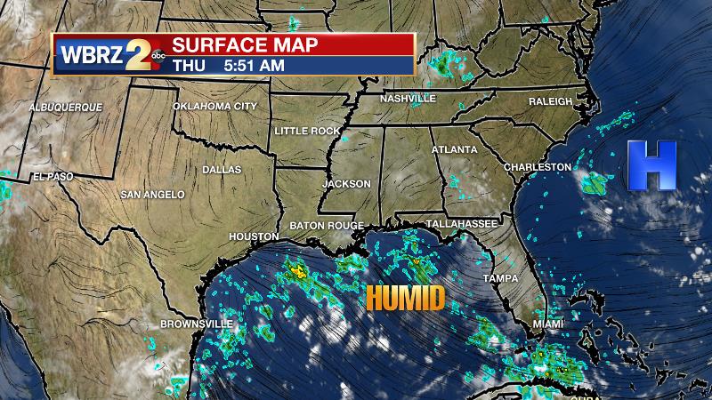
Today and Tonight: Expect morning sunshine to send thermometers into the low 90s before a round of showers and thunderstorms break out during the late morning hours. Action will last through late afternoon, never raining constantly on one location. As you know, some spots could miss rain entirely. Those that do not are subject to downpours. 40 to 60 percent rain coverage is expected in our area. Overnight will be quieter with lows in the mid 70s.
Up Next: Deep southeasterly wind flow across the Gulf will continue to keep the surface and the atmosphere soupy. This stagnant setup will result in scattered showers and thunderstorms to develop each day through early next week. Particularly Saturday through Monday, a fast moving disturbance in the northern Gulf may enhance showers and thunderstorms a bit. By the end of next week, a tropical low could bring even more active weather to the region.
Football Is Back: For those making a trek to Dallas and Forth Worth this weekend, the key weather feature will be heat. Afternoon high temperatures will be in the mid to upper 90s with overnight lows in the mid to upper 70s. No rain is in the picture. Southern gets the party started on Saturday at TCU with a kickoff temperature of 90 degrees and an end of game temperature closer to 100 degrees. LSU fans will feel that heat before the game inside of AT&T Stadium and will exit the building to thermometers in the mid 80s.
#BREAKING: a new tropical system forming off the African Coast is expected to become Hurricane #Florence. At this time, it is not a threat to the U.S. pic.twitter.com/hzh0PAAIVm
— WBRZ Weather (@WBRZweather) August 30, 2018Trending News
The Tropics: A new tropical system forming off the African Coast is expected to become Hurricane #Florence. At this time, it is not a threat to the U.S.
Much closer to home, a trough or weak area of low pressure is expected to develop near Florida after the weekend. The Weather Prediction Center is now including this system on their forecast maps. Computer models have shown a number of scenarios that indicate some development is possible with a system moving into the Gulf of Mexico during the middle of next week. That same area of high pressure that has kept the local weather so persistent, sticky and stormy of late will remain in place to steer any system generally west-northwestward through the Gulf. Keep in mind though, models perform poorly when no system has developed to track. Therefore confidence is low in any strength, timing, track or if a storm even develops in the first place. At this point, we just need to keep an eye on the forecast.
THE EXPLANATION:
An upper level ridge of high pressure will remain centered over the western Atlantic Ocean and northeastern U.S. leaving minimal subsidence in place over the central Gulf Coast. At the surface, high pressure over the Mid-Atlantic will continue to allow deep southeasterly flow to keep lots of moisture over the region. Precipitable water or available moisture in the atmosphere will increase to 2.25 inches, nearly a record for the time of year, over the weekend. As a result, measurable rain coverage will increase from 40 to 50 percent to 60 to 70 percent. In terms of temperatures, outside of storm influences, highs should be near average each day. Torrential rain will be possible due to the high moisture content, storm motion will have to be monitored as slow-movers could lead to localized flooding. Not much will change next week. The Weather Prediction Center is depicting an area low pressure developing near Florida on Tuesday in response to a westward bound tropical wave currently moving through the Caribbean Sea. Forecast models have latched on to this wave and been showing a closed circulation developing in the northeastern Gulf. The strong area of high pressure in the western Atlantic is likely to stayed locked in place sending impulses and any tropical systems that can develop from east to west across the Gulf. The GFS model has been the weaker and further west solution while the ECMWF has been the stronger and further east solution. The bottom line is that as effective as forecast models can be, they are limited when it comes to tropical systems that have not yet formed. Confidence will be low and details unclear until a system forms and we get closer in time. Continue to monitor this scenario for now.
--Dr. Josh
The WBRZ Weather Team is here for you, on every platform. Your weather updates can be found on News 2, wbrz.com, and the WBRZ WX App. on Apple and Android devices. Follow WBRZ Weather on Facebook and Twitter for even more weather updates while you are on the go.
More News
