

Latest Weather Blog
Overnight showers and storms may be strong or severe
The next round of showers and storms will be here later tonight.
Today is National "Safe Place Selfie" Day! We join our partners at the National Weather Service in promoting and teaching severe weather safety. CLICK HERE to learn more and be sure to send your safe place selfie to weather@wbrz.com so we can share it on social media!
THE FORECAST
Today and Tonight: There will be a few more clouds around today and afternoon temperatures will be in the low 80s.
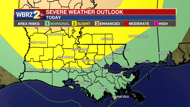
NEW The level 2/5 "slight risk" for severe weather has shifted south to include most of the Baton Rouge Metro. Around 8 pm a line of showers and storms will approach the northwest corner of the viewing area. Some of these storms may be strong to severe especially for areas closest to Mississippi. The main threats will be damaging straight line winds and heavy rain. We can't rule out a tornado or two. It is expected to reach Baton Rouge around midnight and push southeast out of the viewing area by daybreak Thursday.
Thursday: After the cold front moves through, the rest of Thursday will be mostly dry. Temperatures will be in the low 80s and there will be ample moisture for a few afternoon showers. Overnight temperatures will be in the 60s.
Trending News
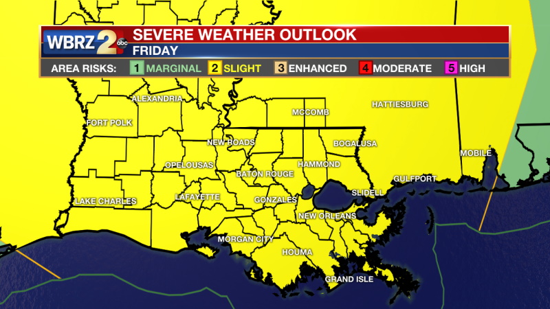
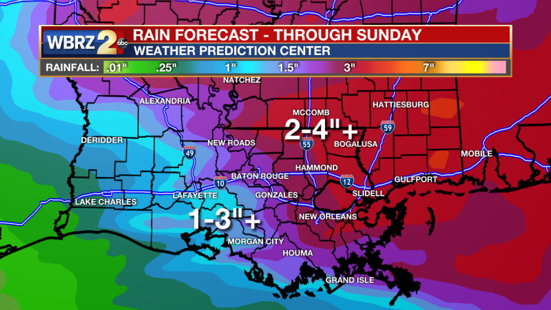
Into the Weekend: On Friday, the entire WBRZ viewing area is under a level 2/5 “slight risk” for severe weather. Storms are set to move through in the evening hours and some of them may become severe. The highest threat right now is strong straight-line winds. There will likely be several rounds of rain Friday into Saturday. The details on timing and location will become clearer as we get closer to Friday, but what gets started on Friday will likely continue through most of the day Saturday. Rain totals when all is said and done will be 2-5 inches. As always, isolated higher amounts will be possible. Click here to see the 7-day forecast.
Reminder: With the threat for impactful weather—strong thunderstorms—please have access to alerts through Saturday evening. You can download or activate the WBRZ WX App on your Apple or Android device or turn on a NOAA Weather Radio for bulletins such as watches and urgent warnings. Of course, WBRZ, WBRZ+, and the Cable Weather Channel will have updates as active weather dictates.
More News
