Thursday PM Forecast: Changes to the weekend forecast
While not zero, rain chances are low going forward. Showers and storms remain possible on a very spotty basis into the weekend. By early next week, rain chances fade away and you might even notice a drop in the humidity.
Tonight & Tomorrow: Partly cloudy skies are anticipated overnight and into Friday morning. Isolated storms cannot be ruled out on Thursday evening either. Aside from a stray shower or two early Friday morning, most of the area will be dry. We expect partly sunny skies on Friday along with a spotty storm chance. It will be another warm day with highs in the lower-90s.
Up Next: The latest data suggest that the weekend will be drier than initially anticipated. This bodes well if you have weekend plans outside. Nevertheless, we won’t totally rule out a spotty thunderstorm on Saturday and Sunday. It’ll be warm also, with highs in the low to mid-90s. We’ll generally see decreasing clouds on Sunday. By early next week, sunshine will dominate. Although temperatures will not vary all that much from day to day, the humidity should drop to more comfortable levels next week.
Get the latest 7-day forecast and real time weather updates HERE.
Watch live news HERE.
Trending News
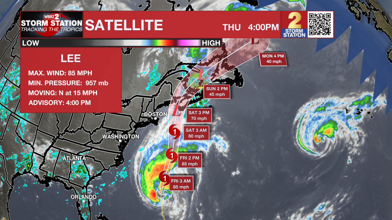
Tropics: Hurricane Lee is accelerating north across the western Atlantic Ocean with maximum sustained winds of 85mph. Tropical Storm Warnings are in place across the coast of New England and dangerous surf and rip currents are expected much of the United States East Coast. The storm will continue north and eventually turn northeast as it nears the coast Friday and Saturday. While Lee may begin to lose some tropical characteristics and wind speeds will decrease somewhat, the storm will remain large and dangerous bringing storm force winds, 1-3 feet of surge and 1-4 inches of rain to that region.

Hurricane Margot is expected to slowly loop over the central Atlantic Ocean west of The Azores. As the storm makes a clockwise loop over its former path, gradual weakening is expected.
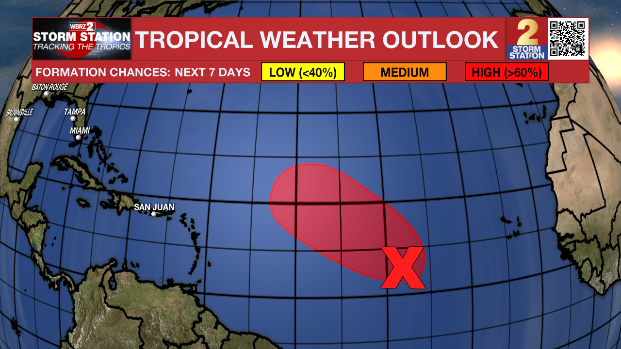
Showers and thunderstorms show some organization in association with a broad low pressure area located about midway between the Lesser Antilles and the Cabo Verde Islands. Environmental conditions are expected to be conducive for additional development, and this system is very likely to become a tropical depression during the next day or so while it moves west-northwestward to northwestward at 10 to 15 mph across the central tropical Atlantic.

-- Meteorologist Malcolm Byron
The Storm Station is here for you, on every platform. Your weather updates can be found on News 2, wbrz.com, and the WBRZ WX App on your Apple or Android device. Follow WBRZ Weather on Facebook and Twitter for even more weather updates while you are on the go.


