

Latest Weather Blog
THE LATEST: Heavy rain threat, river levels and forecast
In addition to heavy rain associated with the remnants of Tropical Storm Arthur, embedded thunderstorms could pose a risk for isolated, brief tornadoes tonight. The Tornado Watch has been dropped but and a FLOOD WATCH remains in effect through Friday morning. Widespread additional amounts of 3-6 inches of rain with “streaks” of 6-12 inches are likely. If those amounts occur in our cities rather than open marsh or swamp land, it will trigger significant poor drainage and river flooding.
6:05am: Heavy rain continues over the eastern areas with flooding happening between Gonzales and New Orleans. More flooding is possible over the northshore areas before tapering off later this afternoon. The Tornado watch has been cancelled for the Capital area.
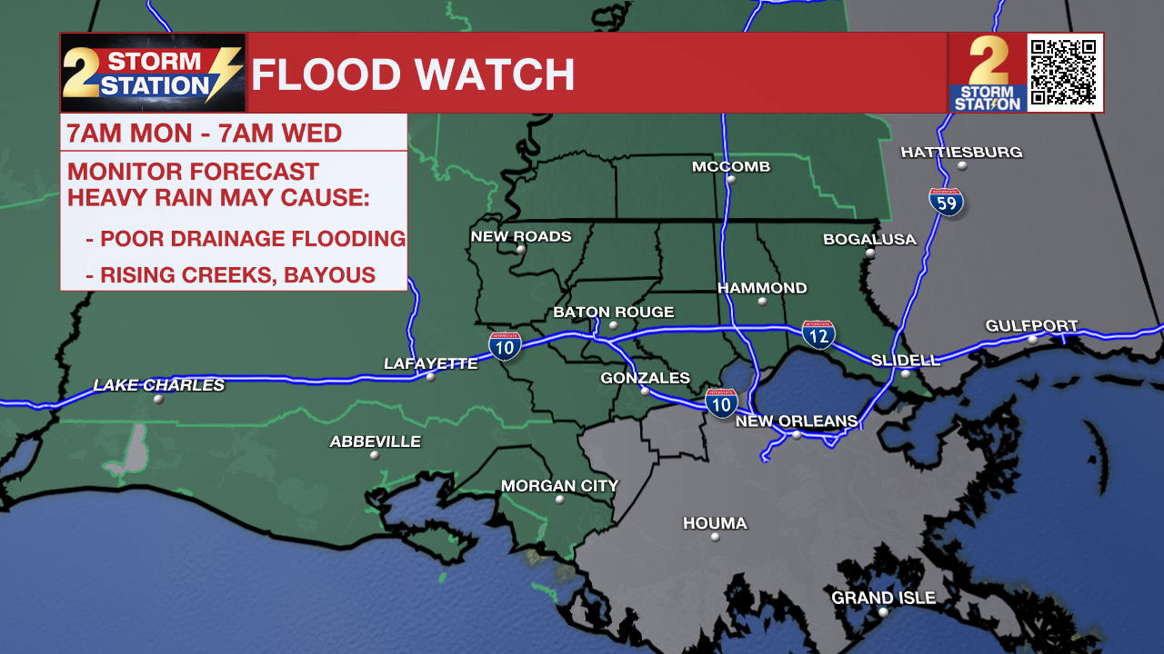
A FLOOD WATCH remains in effect for the entire Capital Region through Friday morning. A FLASH FLOOD WATCH means conditions may develop that lead to flash flooding. Flash flooding is a very dangerous situation. Be on the lookout for threatening weather conditions and listen for later statements and possible warnings. For more on flooding safety, CLICK HERE.
Tonight and Tomorrow: The overnight will have very impactful weather. Heavy rain will move across southeast Louisiana and coastal Mississippi. Rain will be likely for most of the night. Rates will be incredibly high in some places, and could quickly lead to flash flooding. Driving will be dangerous overnight, and the morning commute will be messy in the hardest-hit areas. Prepare for much slower drive times and the possibility of flooded roadways. In addition to the heavy rain, leftover energy in the atmosphere from the remnants of Tropical Storm Arthur could also lead to an isolated, brief tornado.
Trending News
Thursday, more and more breaks in rain can be expected through the day. To be clear, though, scattered showers and thunderstorms will remain possible and capable of heavy rain in a short time. Occasional breaks of sunshine will help highs into the upper 80s, and it will still feel very humid in the leftover tropical air mass.

Use the slider to advance through the next 24 hours of Futurecast
Up Next: On Friday, the tropical system will finally pull away to the east. Scattered showers and thunderstorms will develop due to lingering tropical moisture. Expect a slow, gradual lowering of daily rain coverage with the pattern moving back toward daytime warming pop-up thunderstorms over the weekend. Humidity will stay in place and highs will return to the 90s.

Get the latest 7-day forecast and real-time weather updates HERE.
Watch live news HERE.
The Tropics: Arthur degenerated into a post-tropical low-pressure area 85 miles west-southwest of Lake Charles, Louisiana. The system had maximum sustained winds of 35mph with a minimum central pressure of 1000mb and was moving northeast at 9 mph. All coastal watches and warnings have been discontinued, and further wind weakening is expected as the remnants move deeper inland over southeastern Texas and western Louisiana into Thursday.
River Flooding: With recent heavy rain and more storms on the way, several local river gauges are forecast to rise. To track conditions, find the latest river levels and forecasts below, updated twice every hour.


— The Storm Station Meteorologists
The Storm Station is here for you, on every platform. Your weather updates can be found on News 2, wbrz.com, and the WBRZ WX App on your Apple or Android device. Follow WBRZ Weather on Facebook and X for even more weather updates while you are on the go.
More News
