

Latest Weather Blog
Saturday PM Forecast: Dense fog tomorrow morning, cold front on Monday
Dense fog will once again be possible tomorrow morning. Visibility could get less than a quarter of a mile. A strong cold front will arrive on Monday which will drastically lower temperatures.
Tonight & Tomorrow: We will dip down into the mid 60's tonight with dense fog once again being a possibility. A *Dense Fog Advisory* has been issued until 9am tomorrow morning. Visibility will be less than a quarter of a mile at times. Please be extremely careful if driving in these condition.
After the morning fog burns off, temperatures will climb back up into the upper 80's. This could potentially tie or break the record high temperature for the day. Skies will be partly sunny with winds out of the south at around 8 mph. It will also be dry which will limit humidity and rain chances.
Up Next: The big pattern change comes on Monday. A cold front will enter during the day which will bring with it some rain chances and a lot cooler temperatures. The best chance for some rain is going to be late Monday into Tuesday morning. Rain coverage is held at 20% for now but could need to be slightly raised by tomorrow if confidence in rain increases. High temperatures are only going to max out around 62 degrees Tuesday and Wednesday. Low temperatures by Wednesday and Thursday morning could reach the 30's.
Get the latest 7-day forecast and real time weather updates HERE.
Trending News
Watch live news HERE.
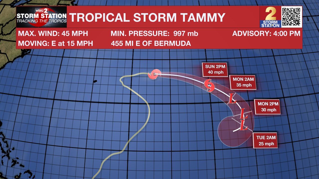
The Tropics: Tammy has max sustained winds of 45 mph. It will continue to drift to the east into the open Atlantic which means it is no threat to the United States.
A small area of low pressure has formed about 120 miles northeast of the coast of the Dominican Republic with disorganized shower and thunderstorm activity. Some development of this system is possible during the next couple of days while it moves northwestward, east of the Bahamas. Upper-level winds are forecast to become too strong for further development by late Monday while the system turns northward east of the northwestern Bahamas.
An area of disturbed weather continues over the southwestern Caribbean Sea in associated with a broad area of low pressure. Further development of this system appears unlikely while it drifts northward or north-northwestward over the central Caribbean Sea.
-- Balin
The Storm Station is here for you, on every platform. Your weather updates can be found on News 2, wbrz.com, and the WBRZ WX App on your Apple or Android device. Follow WBRZ Weather on Facebook and Twitter for even more weather updates while you are on the go.
More News
