Front brings seasonable feel locally, snow to northeast
A cold front arrives today on the heels of Tuesday’s severe weather outbreak. The same storm system will be responsible for heavy snow and significant travel delays in the Northeastern United States—take note if you will be flying on Thursday or Friday.
THE FORECAST:
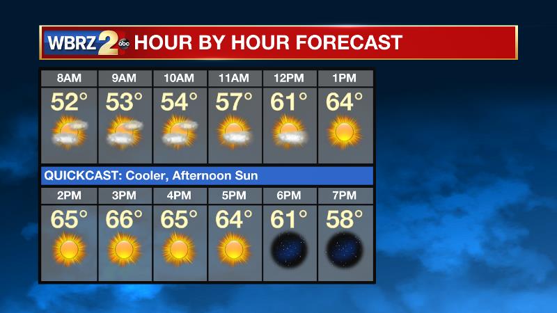
Today and Tonight: Your Thursday will be cooler with highs much closer to average in the mid 60s. Some mid and high level clouds are expected during the first half of the day with more blue and sun showing up in skies for the second half of the day. Overnight will be clear with lows in the mid 40s.

Up Next: The February feel will leave as quickly as it arrived, however. Temperatures are expected to return to the 70s on Friday and possible the 80s by Sunday. While we expect to see some sun on Sunday, clouds will increase into the evening and some late night showers or early morning thunderstorms may follow. This is related to another system which should knock our temperatures back down a peg. Tuesday is Valentine's Day, and with some lingering rain and storms expected, plan your picnic carefully!
THE SCIENCE: With a cold front slipping south, a surface high will move over the Mid Mississippi River Valley today, maintaining a northerly wind. High pressure will continue to slide east tonight Friday and winds will become more easterly and southeasterly late. As the surface high moves into the Eastern Atlantic this weekend, southerly flow will return moisture and dewpoint readings will increase back into the 60s on Saturday and mid 60s by Sunday. Very isolated showers may fall Saturday Afternoon in area north and west of Baton Rouge. Light southerly winds, mostly clear skies and radiational cooling may allow fog development Sunday morning. An approaching front will bring the next shot at rain across the forecast area Sunday Night and Monday. Cooler temperatures will make another brief appearance behind the wet weather by the middle of next week.
Trending News
--Josh


