

Latest Weather Blog
Friday PM Forecast: strong cold front to deliver wintry feeling weekend for Capital Area
Significant changes are on the way for what will feel like a wintry weekend. As for it looking like winter, the chances for a few snow flurries have continued to trend down—toward almost zero—for the Capital Area.
Weekend: cloudy start, cold and clear finish
Early Next Week: chilly, some sun
Late Next Week: returning rain chances
Tonight & Tomorrow: A cold front is set to move through late tonight. With the front, some passing light showers will be possible primarily between 9pm – 4am. As the boundary clears the coast, it will sweep away the seasonably mild air and bring a winter chill in time for the weekend. Saturday will begin in the upper 40s, but thanks to cloud cover and chilly north winds, temperatures will not rebound much further than the mid 50s.
Trending News
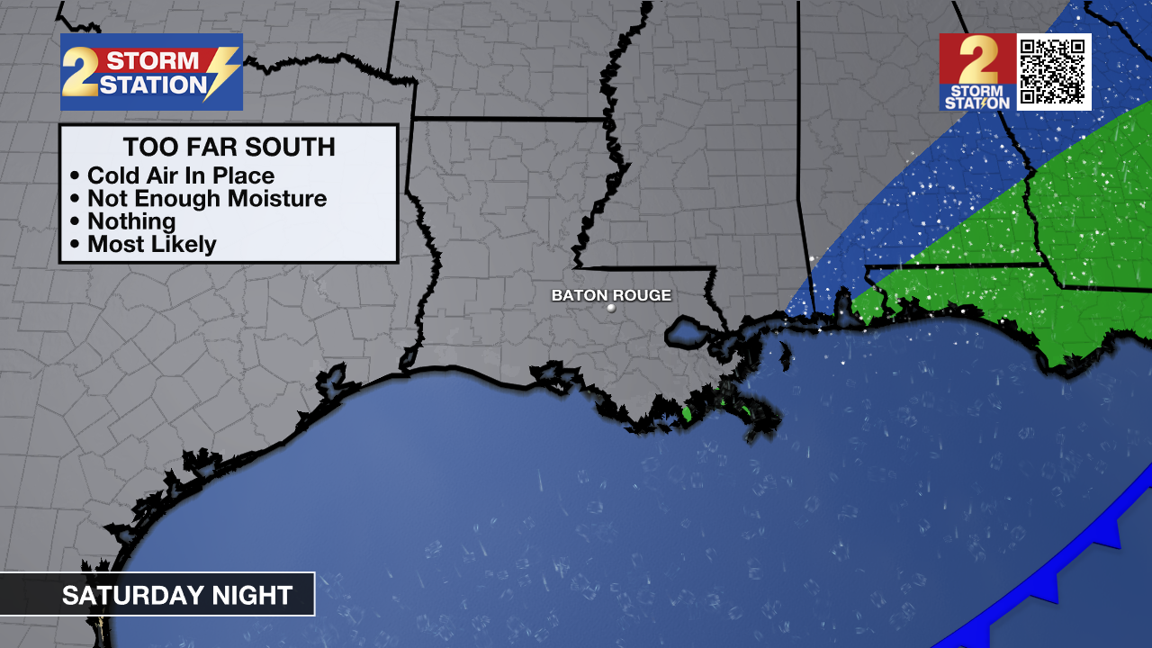
Snow Chance: As temperatures tumble Saturday night, there is a very brief window where some sprinkles or possibly a few snowflakes could fall, particularly for locations north of I-12 and east of I-55. Know that the overall precipitation coverage or chance will be very low, at about 10%. There will not be any accumulation because the ground is too warm, and the air will dry too fast for any precipitation to last. The main impact will simply be the cold; blustery north winds could drop wind chills into the 20s or even teens by Sunday morning, so make sure to protect people, pets, and plants!

Up Next: On Sunday, if you are heading out early for services or breakfast, you will definitely need the heavy coat. While full sun will be around through the day, it won’t do much to warm temperatures. Expect the coldest afternoon of the forecast, with highs barely hitting the low 50s.
The cold grip holds on through Monday for Martin Luther King Jr. Day. It will be a beautiful, sunny day for outdoor commemorations, but temperatures will remain crisp with morning lows near freezing and afternoon highs reaching the upper 50s. Layers will be your best friend if you plan to be outside for the holiday.
Looking ahead to the rest of the workweek, there will be a slow climb back to milder weather. A thaw will happen on Wednesday with lows above freezing and highs into the 60s. Clouds will thicken up, and rain chances then return to the forecast—sitting at 30% late Wednesday and bumping up to 40% by Thursday.
Get the latest 7-day forecast and real-time weather updates HERE.
Watch live news HERE.
– Josh
The Storm Station is here for you, on every platform. Your weather updates can be found on News 2, wbrz.com, and the WBRZ WX App on your Apple or Android device. Follow WBRZ Weather on Facebook and X for even more weather updates while you are on the go.
More News
