

Latest Weather Blog
February 26, 2020 AM Weather
Related Story
THE FORECAST:
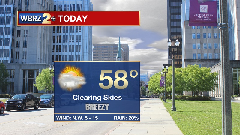
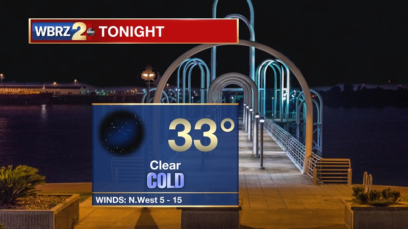
Today and Tonight: Some light showers possible through the morning hours, especially north of the I-10 corridor. This drizzle is associated with a passing cold front that should also keep clouds overhead through the majority of the day. Temperatures will be slow to warm through the day, with highs only peaking near 58°. Winds will also be quite blustery between 10 to 15 mph, with gusts around 20 mph expected through the afternoon. Clouds will break tonight, leading to clear skies and cold conditions. Temperatures will free-fall after sunset, with overnight lows bottoming-out near 33° heading into Thursday morning.
Up Next: Sunny skies through the weekend, with temperatures slowly warming back into the mid-to-upper 60 by Sunday. Next batch of showers moving through early next week.
THE EXPLANATION:
A fragmented and weak cold front is bringing some light drizzle across the area this morning, but that should shift east and north through the morning and early afternoon hours. After 9 AM, rain chances will be very low south of the I-10 corridor. Winds will be elevated through the day, before slowing down out of the northwest overnight. These lower north winds along with clear skies will allow for temperatures to drop quickly tonight and near freezing into Thursday morning. High pressure will slide into our area, keeping skies sunny but high temperatures will still be well below average through the remainder of the workweek. A high pressure center should press into South Texas before travelling through the Gulf Coast Friday and into the weekend. This high will bring with it warmer temperatures from out southwest, helping high temperatures to approach the 70s on Sunday. A low pressure system will develop in Oklahoma on Sunday, before pressing into Illinois and Indiana early next week. The associated frontal system will try to extend south into the Gulf, but will have a tough time staying together. Even though it will be breaking up as it nears our area, it will still have just enough strength to provide light to moderate showers Monday and Tuesday – with current models hinting at Tuesday being the wetter day.
--Meteorologist Matt Callihan
The WBRZ Weather Team is here for you, on every platform. Your weather updates can be found on News 2, and the WBRZ WX App. on Apple and Android devices. Follow WBRZ Weather on Facebook and Twitter for even more weather updates while you are on the go.
News
