Tuesday AM Forecast: Patchy dense fog possible for Tuesday morning commute
Patchy dense fog will once again be possible for the Tuesday morning commute. As has been the case in recent days, any fog that does form will lift by late morning. We’ll turn mostly sunny for the afternoon with warm and breezy conditions.
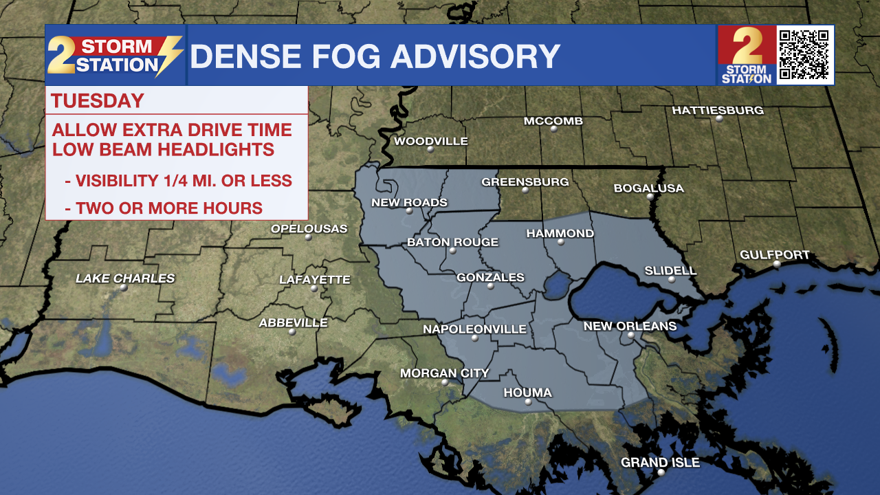
Today & Tonight: A Dense Fog Advisory is in effect for portions of southeast Louisiana through 10 a.m. Tuesday, including the Baton Rouge metro area. Visibilities below 1/4-mile are possible in the gray-shaded parishes.

While there is a little bit of wind that might try to limit the fog potential, wind speeds are calmer in some locations producing patches of dense fog. On top of that, we’re also watching the potential for smoke to mix in. The smoke-fog combination results in even denser areas of fog, especially along/east of Baton Rouge.
Any fog will lift by late morning, giving way to mostly sunny skies by afternoon. This will help push high temperatures into the upper-80s for highs, which is roughly 10° above average for late October. There will be a breeze too, with winds out of the east and southeast upwards of 15-20 mph. A slight breeze sticks around overnight Tuesday, which will help limit the widespread dense fog potential early Wednesday.
Up Next: It’s almost a “copy and paste” type of forecast in the extended range. High temperatures remain in the upper-80s through the weekend, and rain chances are limited also. We will include a 10% rain chance on Wednesday and Thursday as there might be just enough moisture to get a few sprinkles underway. However, this will not be a drought-busting rain, nor will many actually observe it.
Trending News
Get the latest 7-day forecast and real time weather updates HERE.
Watch live news HERE.
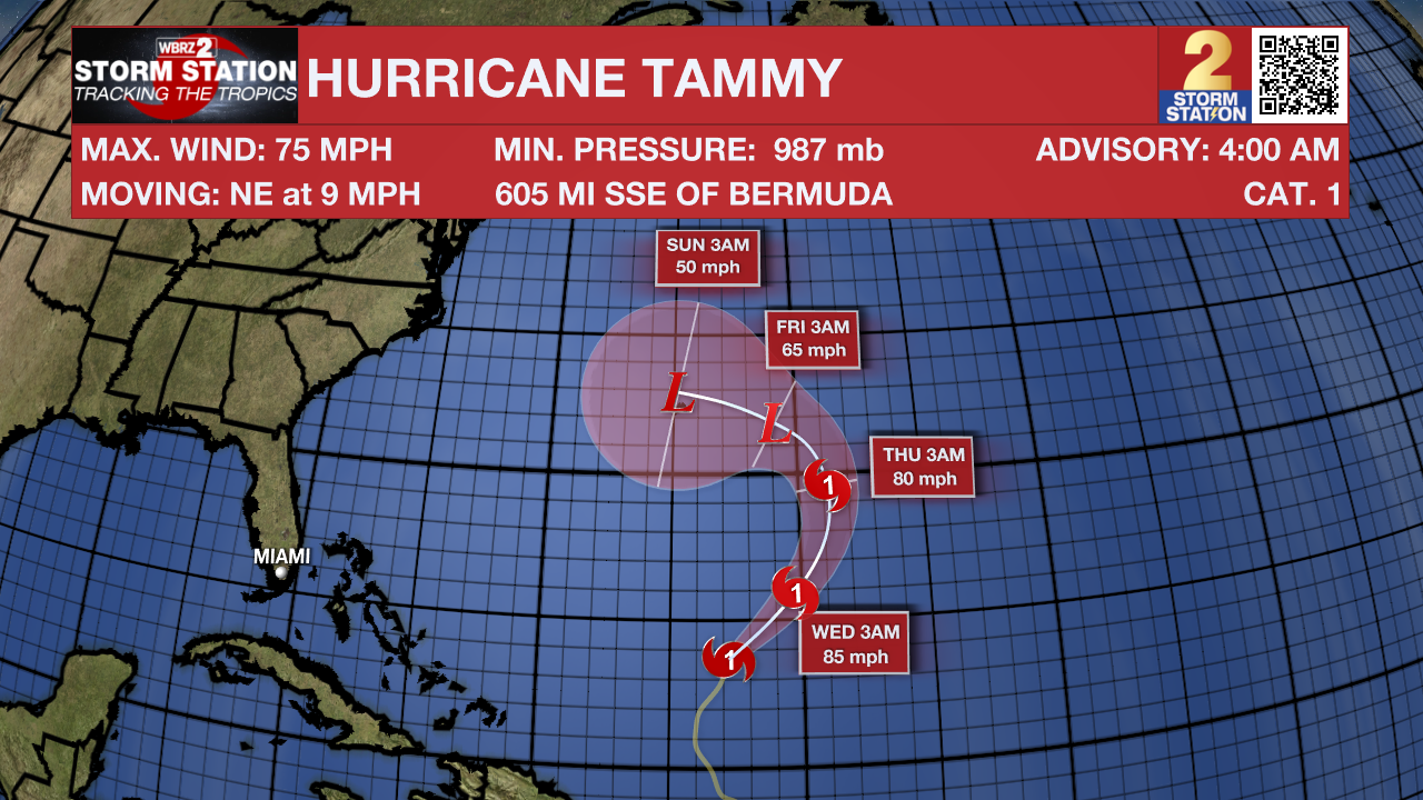
The Tropics: Hurricane Tammy continues to drift northeast in the Atlantic basin as a Category 1 hurricane with maximum winds at 75 mph. By late week, the storm should begin to take more of a westward turn. However, the general trend will be for the storm to weaken and become post-tropical by the weekend as Tammy moves into cooler waters.

Tropical Depression Twenty-One developed in the southwest Caribbean on Monday. The system has already made landfall in Nicaragua and will fizzle out later on Tuesday. Twenty-One will remain an unnamed tropical system.
-- Meteorologist Malcolm Byron
The Storm Station is here for you, on every platform. Your weather updates can be found on News 2, wbrz.com, and the WBRZ WX App on your Apple or Android device. Follow WBRZ Weather on Facebook and Twitter for even more weather updates while you are on the go.


