

Latest Weather Blog
Tuesday AM Forecast: A frigid start, but sun will warm us up
Extreme cold lingers this morning before slow moderation begins. While the worst of the Arctic blast will ease, freezing temperatures and cold nights remain a concern.

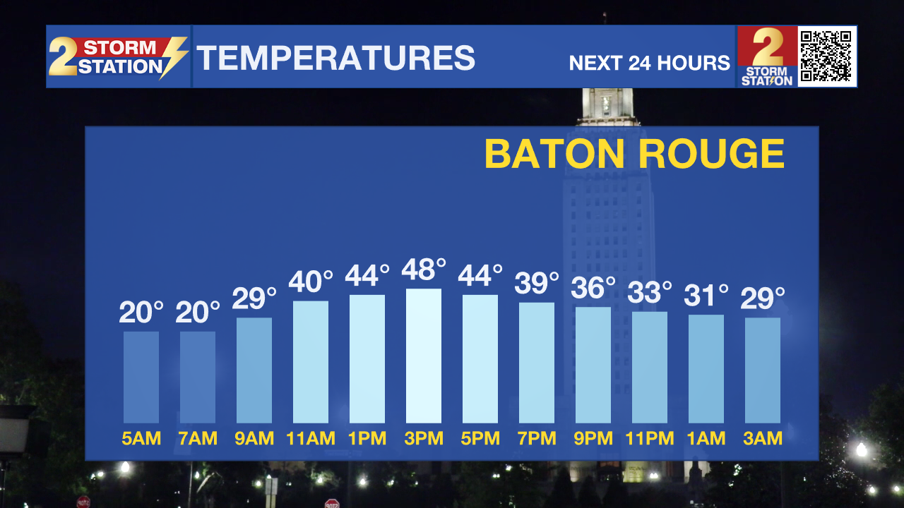
Today and tonight: We begin the day with another frigid morning. Temperatures are below freezing over the entire area, with most areas in the upper teens and lower 20s. An Extreme Cold Warning remains in effect until noon. Sunshine should help temperatures recover into the mid to upper 40s by afternoon — still well below normal. Skies remain clear Tuesday night, allowing temperatures to fall back toward freezing once again.
Trending News
Up Next: A reinforcing cold front arrives later this week, keeping temperatures a good 10 degrees below average through midweek. Highs will hover in the low 50s on Wednesday and Thursday, with another round of freezing temperatures possible on Wednesday night. Attention then turns to late week, where another system from Friday into Saturday could bring light precipitation and renewed cold into the weekend.
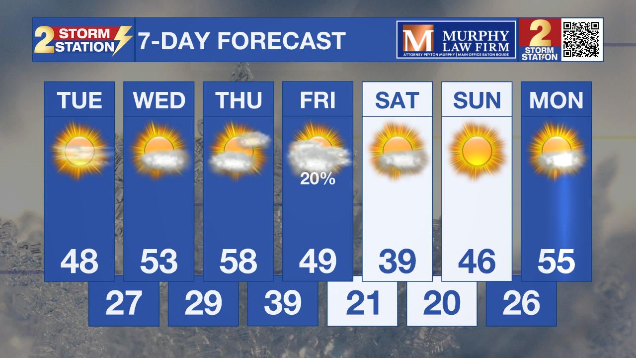
What to look out for: Freezing temperatures on Tuesday morning will be impactful. Additional freeze headlines could be needed for later this week. Another cold surge late week could reintroduce hard freeze concerns.
Get the latest 7-day forecast and real-time weather updates HERE.
Watch live news HERE.
– Dave
The Storm Station is here for you, on every platform. Your weather updates can be found on News 2, wbrz.com, and the WBRZ WX App on your Apple or Android device. Follow WBRZ Weather on Facebook and X for even more weather updates while you are on the go.
More News
