

Latest Weather Blog
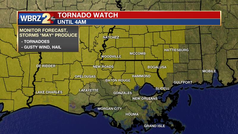
TORNADO WATCH for areas north of I-10
8:30pm Update: A *TORNADO WATCH* has been issued for portions of parts of southeast Louisiana and southwest Mississippi, north of I-10 until 4am Saturday. Within the watch area, the primary threats are: a few tornadoes, scattered damaging wind gusts to 70 mph and scattered large hail events to 1.5 inches in diameter.
Clusters of storms will likely persist well into the overnight hours while spreading eastward from Louisiana into Mississippi. The storm environment will favor damaging winds and large hail with the strongest storms, as well as a few tornadoes with any stronger embedded circulations.
Tonight: Coverage of showers and thunderstorms will increase through the evening hours as a warm front moves north into the area. Along and south of this warm front, ingredients will be favorable for some of the thunderstorms to become severe, with the possibility of gusty wind, tornadoes and hail. Then, a messy cluster, or squall line, is likely to develop and move from west to east across the area between 1 - 3am carrying a greater risk for strong thunderstorms. Additionally, it appears as though areas north of I-12 could be in for some repeated rounds of heavy thunderstorms and there is a threat of flooding. Some spots in southwest Mississippi and neighboring Louisiana parishes could collect a quick 3 - 6 inches of rain with lighter amounts elsewhere. Exactly where the warm front slows down, will be where the heaviest rain occurs. Temperatures will remain steady in the upper 60s.
Trending News
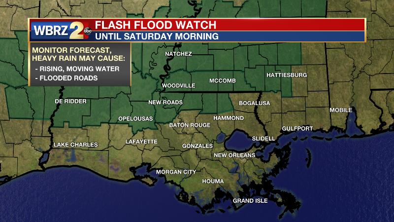
Severe Weather Threat: The WBRZ viewing area has been placed under a risk for severe weather Friday evening, into pre-dawn on Saturday. Locations along and north of I-10/12 are under an Enhanced Risk (Level 3/5), locations south and east of Baton Rouge are in a Slight Risk (Level 2/5). Additionally, a FLASH FLOOD WATCH has been issued for parishes and counties north of Baton Rouge. This is something we have dealt with multiple times this spring season, just be weather aware, have multiple ways to receive warning information and know a safe place to go ahead of time in case a warning is issued.
Up Next: Some lingering showers and thunderstorms will remain possible early Saturday, but the threat for severe weather will be over. Expect a better chance for rain and more clouds during the first half of the day and some sunshine into the afternoon. High temperatures will warm into the low 80s. By Saturday night, a cold front will cross the region the air will cool and dry slightly by Sunday. The morning temperatures will be in the upper 50s followed by a sunny afternoon with highs around 80 degrees. Similar weather will carry into Monday with afternoon highs trending up into the mid 80s for Tuesday and Wednesday. The next chance for organized rain and thunderstorms will come during the latter half of next week. Click here to see the 7-day forecast.
With the threat for impactful weather—severe thunderstorms—please have access to alerts through Saturday. You can download or activate the WBRZ WX App on your Apple or Android device or turn on a NOAA Weather Radio for bulletins such as watches and urgent warnings. Of course, WBRZ, WBRZ+, and the Cable Weather Channel will have updates as active weather dictates.
More News
