

Latest Weather Blog
Monitoring a significant severe weather threat on Tuesday
TONIGHT AND TOMORROW
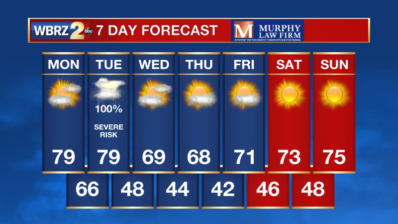
Southerly winds will continue to pull in warmer air from the Gulf tonight and through the day tomorrow. That will keep low temperatures from being as chilly as this morning. Expect to wake up to temperatures in the upper 40s and low 50s. Monday will be a warm and breezy day with highs near 80. Clouds will continue to build in through the day.
LOOKING AHEAD
A significant risk of severe weather is becoming more likely across south Louisiana and southwest Mississippi on Tuesday. We are now in a Level 4/5 (Moderate Risk) for severe weather. SPC notes the potential for strong tornadoes. pic.twitter.com/FsWl90MDC2
— Jake Dalton (@Jake_WX) March 20, 2022
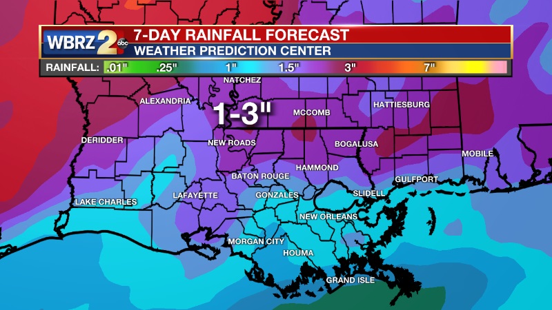
All eyes are on Tuesday's storm threat. This system will have the potential to bring an outbreak of severe weather across our area Tuesday afternoon and evening. The Baton Rouge metro and southwest Mississippi have been placed under a Level 4/5 (Moderate Risk) for severe weather. South of I-10/12, there is a Level 3/5 (Enhanced Risk) for severe weather. The timeline for strong to severe storms to move across south Louisiana and southwest Mississippi is between 1PM-8PM. A squall line is expected to develop that will pose the highest risk for damaging winds. Any individual cells that develop ahead of the squall line will have the potential of producing a tornado. Heavy rain will be something to watch as well, with 1-3 inches of rainfall likely to fall on Tuesday.
While we still have two days of calm weather, now is the time to prepare. Start thinking of a safety plan for you and your family - where you are going to go in the event of a warning. Make sure you stay connected with us for the latest details in the coming days.
Trending News
-- Meteorologist Jake Dalton
More News
