

Latest Weather Blog
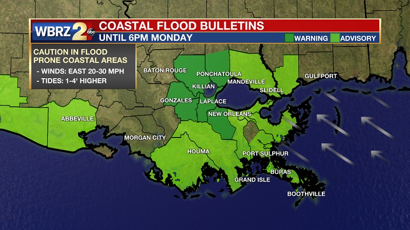
Coastal Flood Warning extended, dry weather continues
Tonight and Tomorrow: Tonight, skies will be partly cloudy with low temperatures in the low to mid 60s. Winds will be light out of the southeast around 5 mph overnight. Tomorrow, expect a mix of sun & clouds in the afternoon with highs in the upper 80s. Winds be will out of the southeast 5 - 15 mph during the day.
Looking Ahead: Strong high pressure to the east continues to be the main driver in our weather. The high will keep us warm and dry through much of the new week. High temperatures will climb to around 90 by the end of the week.
A Coastal Flood Warning remains in effect until Monday evening for parishes surrounding Lake Maurepas, especially east facing shores. A stiff east, to east southeast wind is causing slow drainage of area lakes, rivers, bayous and streams. A decrease in wind speed will help by mid-week, but we really need a change in wind direction for a rapid decline in water levels.
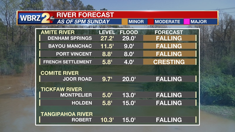
Latest River Levels Updated Sunday PM:
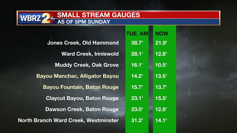
Latest Creek Levels Updated Sunday PM:
For more information on the impacts you could expect near these locations, CLICK HERE and then click on the river gauge site of interest.
The Tropics:
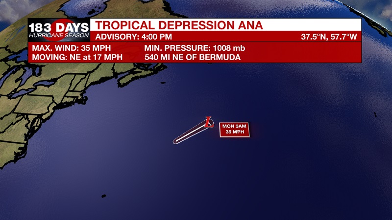
Ana has continued to weaken through out the day due to increased wind shear and dry air, and is now a tropical depression. The system will dissipate over the north Atlantic by tomorrow afternoon.
Trending News
Elsewhere, tropical development is not expected for the next five days.
-- Meteorologist Jake Dalton
More News
