

Latest Weather Blog
Wednesday evening video forecast
Related Story
The next storm system will bring scattered showers and thunderstorms in time for the Friday morning drive. Beyond that, thermometers will gradually work lower and the coldest air in over a year is slated to arrive at the beginning of next week.
Tonight & Tomorrow: Skies will remain mostly clear for much of Wednesday evening, but the clouds return overnight. As a result, temperatures will not get quite as chilly into Thursday morning. We expect an evening/overnight low in the mid 40s. That likely occurs near midnight, with temperatures climbing to about 50 degrees by daybreak. Despite a partly to mostly cloudy start on Thursday, we should see more sun for the afternoon. It will be a warmer day with highs in the low 70s. The breeze will increase out of the southeast at 5 to 15mph.
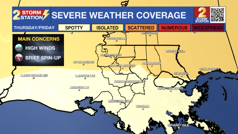
Up Next: A warm front will sweep over the Capital Area late Thursday night. The chance for showers and thunderstorms will increase, especially after midnight, with rain a possibility through around midday Friday. The forecast window for wet weather may well include the morning commute so some delays may be in the cards. In addition, the Capital Area will also face another threat for severe weather. The Storm Prediction Center carries a 2/5 “Slight Risk” for severe weather mainly along and north of I-12. This means that within the risk area, isolated severe weather events are expected. Hazards include damaging winds or a tornado.
With mainly clear skies, Saturday and Sunday will both feature morning lows near or below freezing and afternoon highs in the upper 50s. This tranquil time may be well spent taking precautions for the coldest air in more than a year.
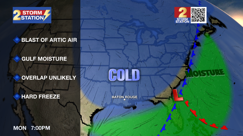
An Artic blast will invade on Monday. Ahead of the cold air, a batch of rain is expected to move across the central Gulf Coast. As of now, it appears unlikely that freezing temperatures will arrive in time for major impacts due to wintry precipitation. It is possible that some sleet briefly mixes in with rain before it ends on Monday. Additionally, wind and dry air following the rain should evaporate leftover moisture and puddles to minimize ice hazards. Regardless of precipitation, there is high confidence that the coldest air so far this season will take over the region. Especially on Tuesday, northerly winds of 10-20mph will cause wind chills in the teens and 20s. Tuesday and Wednesday morning will have several hours in the low to mid 20s. Plan for a hard freeze, taking the necessary precautions on pipes and other home infrastructure this weekend.
Get the latest 7-day forecast and real time weather updates HERE.
Watch live news HERE.
– Josh
The Storm Station is here for you, on every platform. Your weather updates can be found on News 2, wbrz.com, and the WBRZ WX App on your Apple or Android device. Follow WBRZ Weather on Facebook and Twitter for even more weather updates while you are on the go.
News
