

Latest Weather Blog
Tuesday AM Forecast: One more morning in the 30s before a big warmup
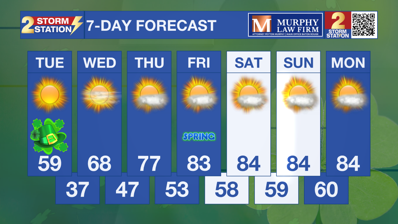
Bundle up! We’re facing back-to-back mornings in the 30s today and Wednesday, which is cold enough to hurt any sensitive plants you've already put in the ground. The good news? We’ll start a steady climb back into warmer territory as we head toward the weekend.
St. Patrick’s Day & Tonight: It will be another cool day across southeast Louisiana with highs in the upper 50s. It will not feel as cool as yesterday since winds will be a good bit lower. Sunshine will dominate all day long, so keep the sunglasses close by! We get cold again overnight with lows in the mid to upper 30s, although freezes are not expected. Still, frost is possible, meaning sensitive plants will need to be covered or brought inside.

Up Next: Get ready for a complete weather 180 as we head through the rest of the week! We’re shaking off the chill quickly, with highs bouncing back into the upper 60s on Wednesday and hitting the upper 70s by Thursday. By the time Friday rolls around to officially kick off Spring, we’ll be soaring into the mid-80s, and you can expect more of that summer-like warmth to stick around all weekend long. If you were hoping for some rain to help the garden, you’re out of luck—the skies are dry for the foreseeable future, with a totally clear forecast for the next 7 to 10 days!
Trending News
Get the latest 7-day forecast and real-time weather updates HERE.
Watch live news HERE.
— Balin
The Storm Station is here for you, on every platform. Your weather updates can be found on News 2, wbrz.com, and the WBRZ WX App on your Apple or Android device. Follow WBRZ Weather on Facebook and X for even more weather updates while you are on the go.
More News
