

Latest Weather Blog
Thursday PM Forecast: dry ahead of a few showers on Saturday
The local area catches a break to end the week with mostly clear skies continuing. While some showers will be around for part of the weekend, neither day is expected to be a wash.
Next 24 Hours: Skies will remain mainly clear overnight with little more than a thin passing clouds. Low temperatures will drop into the mid 40s as winds stay light and northeasterly. Quiet weather will continue to finish the week with mostly sunny skies on Friday afternoon. High temperatures will jump into the mid 70s.
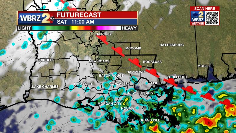
Up Next: A warm front will drift northward toward the Gulf Coast on Saturday morning and that will result in scattered showers and even a few rumbles of thunder to begin the weekend. However, it looks like most of this moisture will be squeezed south by a fast moving, weak cold front. As a result, sunshine will peek back out by the afternoon as highs move to the upper 70s. The current timing of this system would bring drying conditions for the LSU Baseball game at 1pm. Sunday will bring a nice finish to the weekend with mostly sunny skies, low temperatures in the mid 50s and high temperatures in the low 80s. Clouds will return on Monday in advance of the next frontal system set to bring rain and thunderstorms overnight into Tuesday. CLICK HERE for your detailed 7-Day Forecast.
The Explanation: The center of an upper level trough of low pressure, that brought the storm system on Wednesday, will be moving through the region tonight. The cooler and drier air mass will persist through Friday with temperatures that are just barely below average for the time of year. A warm front will drift northward up to the I-10 corridor on Saturday morning as a weak trough of low pressure zips across the Gulf Coast. There should not be enough instability at the surface for this system to produce more than showers and perhaps an embedded thunderstorm. The trailing cold front will quickly swing through on Saturday afternoon and skies should respond to the injection of drier air by clearing. In fact, sunshine is expected to end the day. The quiet and dry conditions will last through Sunday but the upper level pattern will remain active with another trough moving in on Monday. Right now, it looks like that system will not have much surface instability to work with either, so not a huge concern for severe weather at the moment. However, there will be plenty of moisture so a rainy 24-36 hour stretch is possible late Monday through early Wednesday.
Trending News
--Josh
The Storm Station is here for you, on every platform. Your weather updates can be found on News 2, wbrz.com, and the WBRZ WX App on your Apple or Android device. Follow WBRZ Weather on Facebook and Twitter for even more weather updates while you are on the go.
More News
