

Latest Weather Blog
Sunday PM Forecast: Chance for severe storms Tuesday morning
TONIGHT & TOMORROW
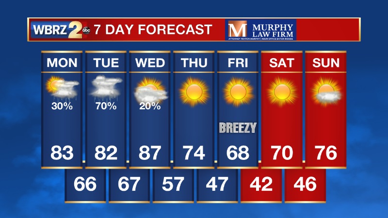
A few clouds will start to mix back in overnight, with low temperatures in the lower 50s. Majority of the day Monday will be dry, as high temperatures climb into the low 80s. Late Monday evening, a few showers and thunderstorms will be possible along a warm front. These will not carry a severe risk.
LOOKING AHEAD
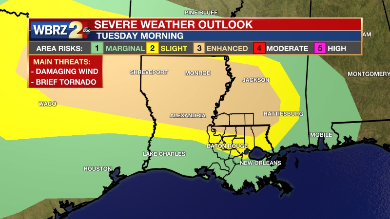
There is now an Enhanced (Level 3/5) risk for severe weather Tuesday morning for southwest Mississippi and the neighboring Florida parishes. A line of intense thunderstorms is expected to track across central Louisiana and eventually into northern portions of the WBRZ viewing area. Location is super important this go around of severe weather. If you live south of I-10, your severe weather risk is significantly lower than those that live north of I-10/12. In fact, coastal parishes may miss out on the rain all together. The main concern with this line of storms will be damaging winds, although a brief tornado can not be ruled out.
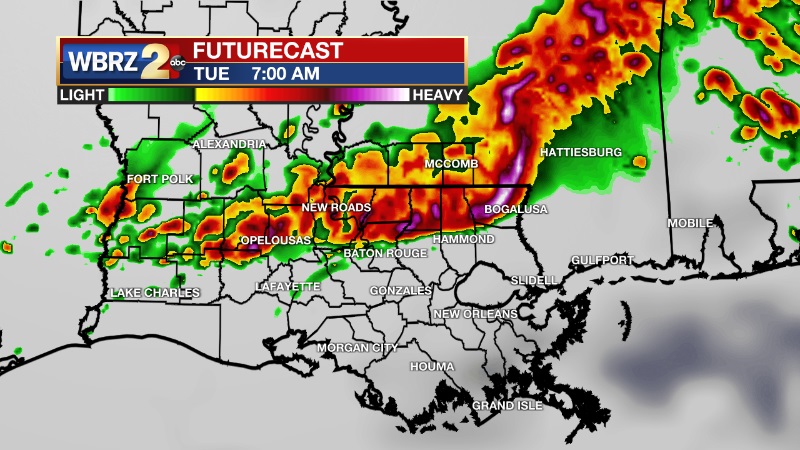
We could pick up 1-2 inches of rainfall where the heavier storms set up. Once this system exits by Tuesday night, we will get to enjoy some nice weather to round out the new week. Temperatures will actually fall below average next weekend, with morning lows that could be in the upper 30s for some.
Trending News
-- Meteorologist Jake Dalton
Your weather updates can be found on News 2, wbrz.com, and the WBRZ WX App on your Apple or Android device. Follow WBRZ Weather on Facebook and Twitter for even more weather updates while you are on the go.
More News
