

Latest Weather Blog
Light afternoon showers today
THE FORECAST:
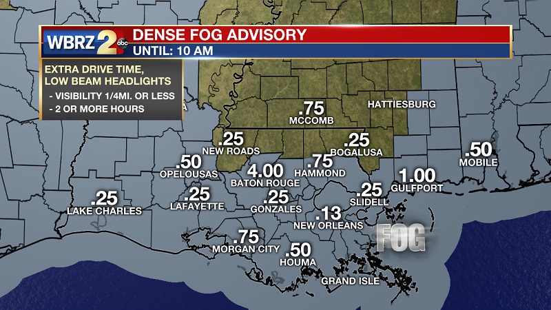
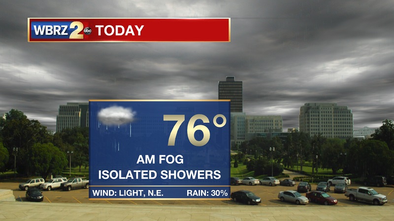
Today and Tonight: A dense fog advisory has been issued across our area until 10 AM, so use extra caution on the roadways this morning. These low clouds will lift by late morning, but clouds will stay overhead. A weak cold front will press into our area from the north, providing isolated light showers through the afternoon. Showers should linger until about 5 PM, with coastal rain chances still elevated until closer to 9 PM. Temperatures still above average, as highs peak near 76° with light winds out of the northeast. Temperatures will be slow to cool tonight, due to the cloud cover, eventually dropping to an overnight low of 56° with stronger winds out of the northwest between 5 and 10 mph.
Up Next: Showers back in the forecast after a brief respite on Wednesday. Showers should stay light today and tomorrow, but become more scattered and stormy on Saturday. Drier and cooler conditions starting Sunday, with temperatures bottoming-out Monday and Tuesday as highs will hover near 50° and lows near 30°.
THE EXPLANATION:
Trending News
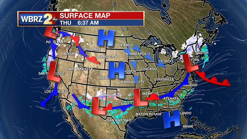
Another foggy morning, but this fog will lift through the late morning hours. A cold front will move through our area around noon today, and press into the gulf shortly after sunset. This front will be falling apart as it makes it to the I-10 corridor, but isolated showers will still be possible until 6 PM around the Capital area. Showers should stay rather light, as rain amounts should stay well below 0.1”. The cold front will stall just offshore before rebounding back onshore on Friday as a warm front, bringing spotty showers back in the forecast to wrap up the workweek. Fog will likely develop Friday night into Saturday morning ahead of a much stronger cold front, providing scattered rain and storms through much of the day – especially through the afternoon hours. The line associated with the cold front will begin to break up through the evening hours on Saturday, as high pressure breaks up the southern end of the front by adding some stability into the atmosphere. Clouds will likely linger through much of the day on Sunday, but should clear late Sunday into Monday. Temperatures will continue to drop into next week, with highs hovering around 50° starting on Martin Luther King Jr. Day and lingering through Tuesday. Temperatures will bottom-out Tuesday morning, with lows near 30°. Conditions start to warm afterwards, with the next system impacting the area by the end of the week.
--Meteorologist Matt Callihan
The WBRZ Weather Team is here for you, on every platform. Your weather updates can be found on News 2, and the WBRZ WX App. on Apple and Android devices. Follow WBRZ Weather on Facebook and Twitter for even more weather updates while you are on the go.
More News
