

Latest Weather Blog
Wednesday AM Forecast: Scattered afternoon storms continue through the weekend
A few more showers and storms in the map this afternoon.
THE FORECAST
Today & Tonight: Before any rain gets here, temperatures will be in the mid-90s with high humidity. Isolated shower activity will start to bubble up after 12 p.m. and then, a line of showers and storms is expected to move through the area later in the evening. Expect storms to be very efficient rain makers, producing 3-5 inches of rain per hour. Good news is that most will be moving through quickly, in one hour or less. If one or two storm cells are moving a bit slower, we could see pockets of street flooding. Drive with caution while it is actively raining. Temperatures tonight will be in the low to mid 70s.
Up Next: Thursday will also bring scattered storms with the majority of the viewing area picking up a shower. Shower activity will start to scale back as we near the weekend. Rainfall totals for the week will be between 1-4 inches with the highest amounts closer to the coast. Isolated higher amounts are expected and there will likely be a few instances of street and poor drainage flooding this week. Overall, the rainfall will be manageable. Thicker cloud cover and rain will help keep temperatures down. High temperatures will trend near 90°, higher for areas that do not see any rain. Click here to see the 7-day forecast.
Reminder: With the threat for impactful weather— heavy rain & flooding —please have access to alerts through this week. You can download or activate the WBRZ WX App on your Apple or Android device or turn on a NOAA Weather Radio for bulletins such as watches and urgent warnings. Of course, WBRZ, WBRZ+ and the Cable Weather Channel will have updates as active weather dictates.
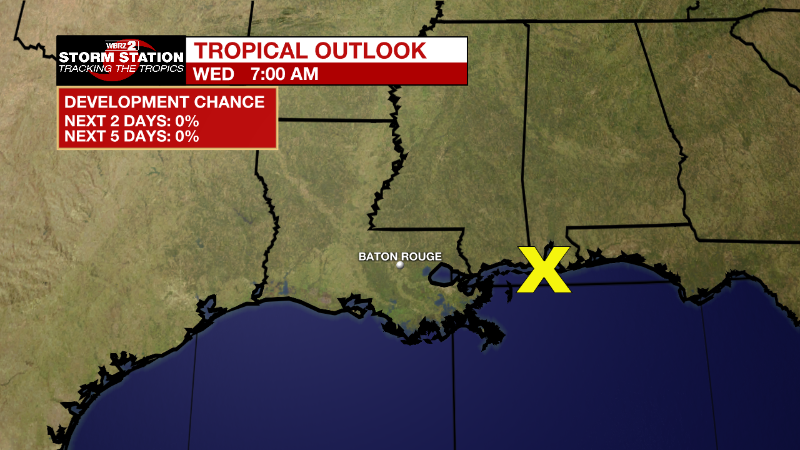
In the Tropics
Trending News
The disturbance in the Gulf is showing very low chances for organization and development. Either way, this will contribute to higher rainfall totals throughout the week as indicated in the forecast discussion.
From the NHC:
A surface trough extending from the Florida Panhandle west-southwestward along the northern Gulf coast is producing disorganized showers and thunderstorms over the northern Gulf of Mexico and adjacent land areas. The surface trough is forecast to drift northward over land during the next few days and significant tropical development is not anticipated. Regardless of development, heavy rains will pose a risk of flash flooding along portions of the northern Gulf coast from Louisiana to the Florida Panhandle over the next several days. For more information about the potential for heavy rain and flooding, please see products issued by your local National Weather Service office and the Weather Prediction Center.
* Formation chance through 48 hours...low...near 0 percent.
* Formation chance through 5 days...low...near 0 percent.
More News
