

Latest Weather Blog
Wednesday AM Forecast: Rain chances increase today, winter storm possible over weekend
We’re heading into a gloomy, wet weather pattern, with rain chances increasing later today. Rain looks likely through the weekend, and as colder air moves in, some areas could see pockets of freezing rain.
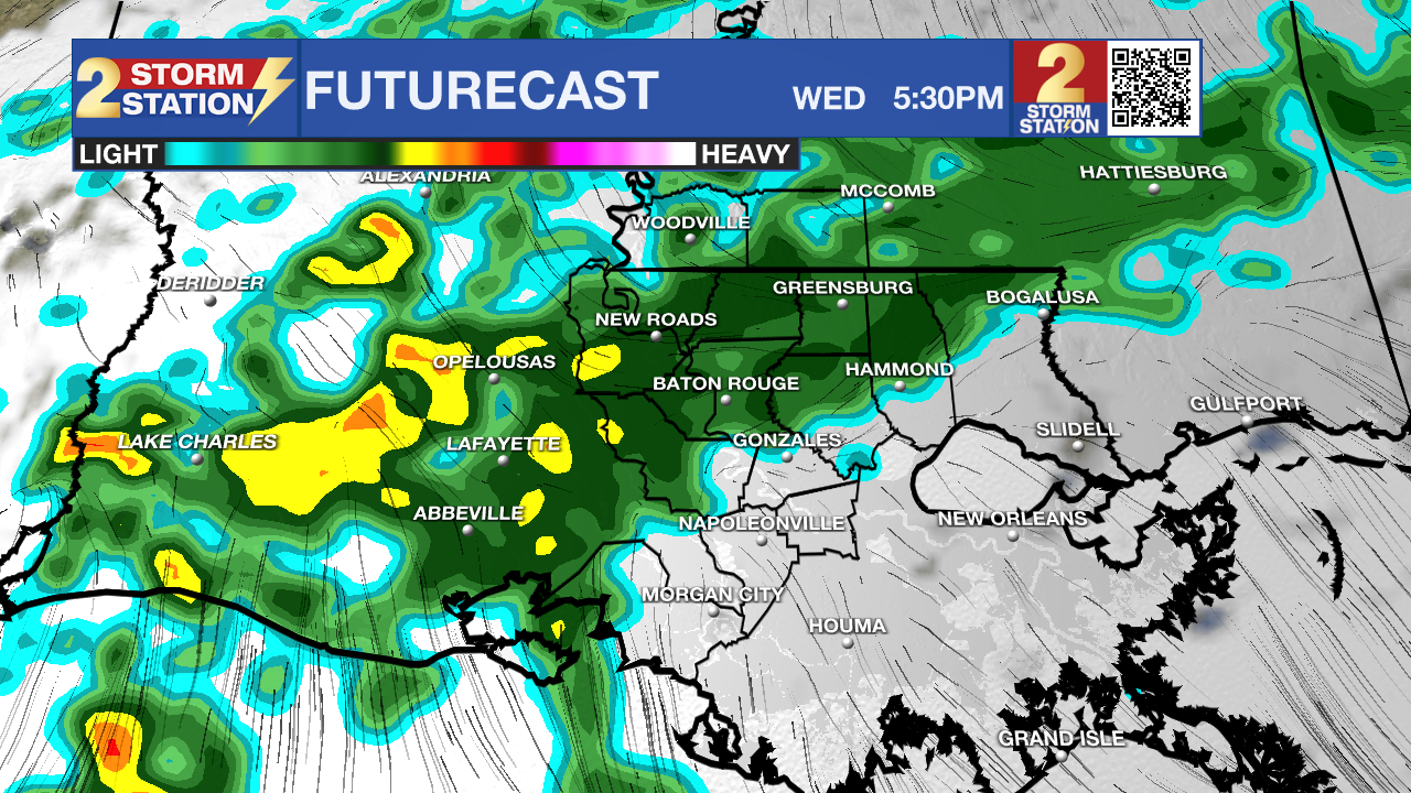
Today & Tonight: It’s not nearly as cold this morning as widespread cloud cover has moved in. Sunshine will be hard to come by today, with highs reaching the mid-60s. As moisture continues to increase and a disturbance moves through later today, shower activity will ramp up. Rain coverage has trended higher overall, with periods of numerous showers possible this evening. While heavy rain isn’t expected, roads could become slick for the evening commute. Showers will remain likely overnight, then turn more spotty early Thursday. Lows will settle into the mid-50s.
Rest of the Workweek: Cloud cover will linger through the end of the week as temperatures continue to climb. Highs will approach 70 degrees, with lows in the mid-50s. Rain chances will be lower than today, though a few isolated showers will still be possible. Bigger changes arrive Friday afternoon and evening as a strong cold front moves through. Temperatures will drop quickly behind it, setting the stage for a much cooler weekend.
Winter Storm Potential: Saturday will feel wintry, with temperatures holding steady or even slipping as the day goes on. A blast of cold air will surge south toward the Gulf Coast while a powerful winter storm takes shape across the southern United States, bringing a wide range of impacts—from snow and ice to heavy rain.
Trending News
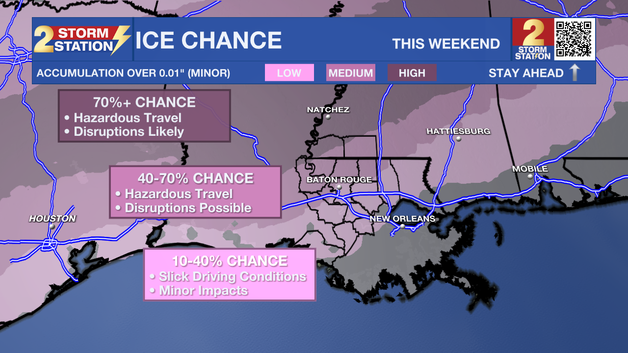
For the Baton Rouge metro, periods of rain are expected through the day. As temperatures continue to fall Saturday night into early Sunday, some areas could see rain change over to freezing rain, mainly north and west of the city toward Mississippi. The highest risk for ice accumulation is expected along and north of a St. Francisville–to–Kentwood line. Along the I-10 and I-12 corridors, the threat for impactful icing remains lower, but not zero. Once temperatures dip below freezing everywhere later Sunday, any leftover moisture could freeze, especially on bridges and elevated roadways.
Small temperature differences will play a big role in how this unfolds—just a one-degree shift can dramatically change impacts. Continue checking Storm Station updates as confidence improves, and be ready to adjust or cancel travel plans this weekend if needed.
.png)
Up Next: Rain and any wintry precipitation will come to an end by Sunday evening, but the cold air will settle in for good. A hard freeze is possible both Monday and Tuesday mornings, with temperatures dropping into the low to mid-20s for several hours. If you haven’t already, take advantage of any dry time later this week to protect exposed outdoor pipes. Both afternoons will bring at least some sunshine, though temperatures will struggle to rebound, topping out in the mid to upper 40s.
Get the latest 7-day forecast and real-time weather updates HERE.
Watch live news HERE.
– Balin
The Storm Station is here for you, on every platform. Your weather updates can be found on News 2, wbrz.com, and the WBRZ WX App on your Apple or Android device. Follow WBRZ Weather on Facebook and X for even more weather updates while you are on the go.
More News
