

Latest Weather Blog
Tuesday PM Forecast: muggy mornings followed by afternoon showers and thunderstorms
The weather pattern will start to seem more like late spring than early spring. Warmth will continue as showers and thunderstorms become a part of the forecast almost daily through the weekend.
Wednesday: scattered showers and thunderstorms
Thursday & Friday: warm, pop-up afternoon showers and thunderstorms
Weekend: dodging rain and thunderstorms
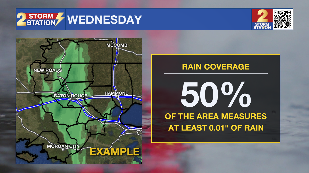
Tonight & Tomorrow: Skies will be mainly clear into the night with low temperatures easing into the mid-60s. Some patchy fog may develop by dawn—especially near bodies of water. Wednesday will be mostly cloudy with some sun poking out through late morning as high temperatures attempt to make it to the low 80s. Warming will eventually be halted by thicker clouds and passing showers and thunderstorms as early as midday. About 50% of the 13 Parish, 2 County Storm Station Forecast Area will receive rain, with quick downpours leaving behind a half inch or so. Some of the showers could linger into the afternoon commute, so be prepared for slick spots.
Trending News

Use the slider to advance through the next 24 hours of Futurecast
Up Next: Though no total washouts are ahead, plan to keep an umbrella close by as you venture out and about. Thursday and Friday will have 30% and 50% rain coverage, respectively, due to "pop-up" variety afternoon showers and thunderstorms.
Saturday and Sunday rain coverage will bump up to 60%. A weak front will try to push into our area from the north. It will never get here to bring cooler air, but it will be close enough to add a little extra trigger for showers and thunderstorms.
Through the weekend, while overall rain totals will stay manageable at 1-2”, a few localized spots could see a downpour exceeding that, which would generally be beneficial for thirsty lawns and gardens. Any outdoor events and plans will need to keep tabs on the radar via the Storm Station Weather App and have an indoor break option in case of passing storms.

Lastly, morning fog will still be possible over the next several mornings due to added moisture streaming in from the Gulf. The most likely spots to have reduced visibility would be near bodies of water, so be ready to occasionally slow it down and use low beam headlights if you hit one of these patches.
Get the latest 7-day forecast and real-time weather updates HERE.
Watch live news HERE.
– Josh
The Storm Station is here for you, on every platform. Your weather updates can be found on News 2, wbrz.com, and the WBRZ WX App on your Apple or Android device. Follow WBRZ Weather on Facebook and X for even more weather updates while you are on the go.
More News
