

Latest Weather Blog
Sunday AM forecast: Cold, Windy, and Dry. Near Freezing Monday and Tuesday mornings.
A strong cold front has pushed through South Louisiana, bringing much cooler air and gusty winds for Sunday. The chilly pattern continues into early next week with freezing temperatures possible by Tuesday morning.

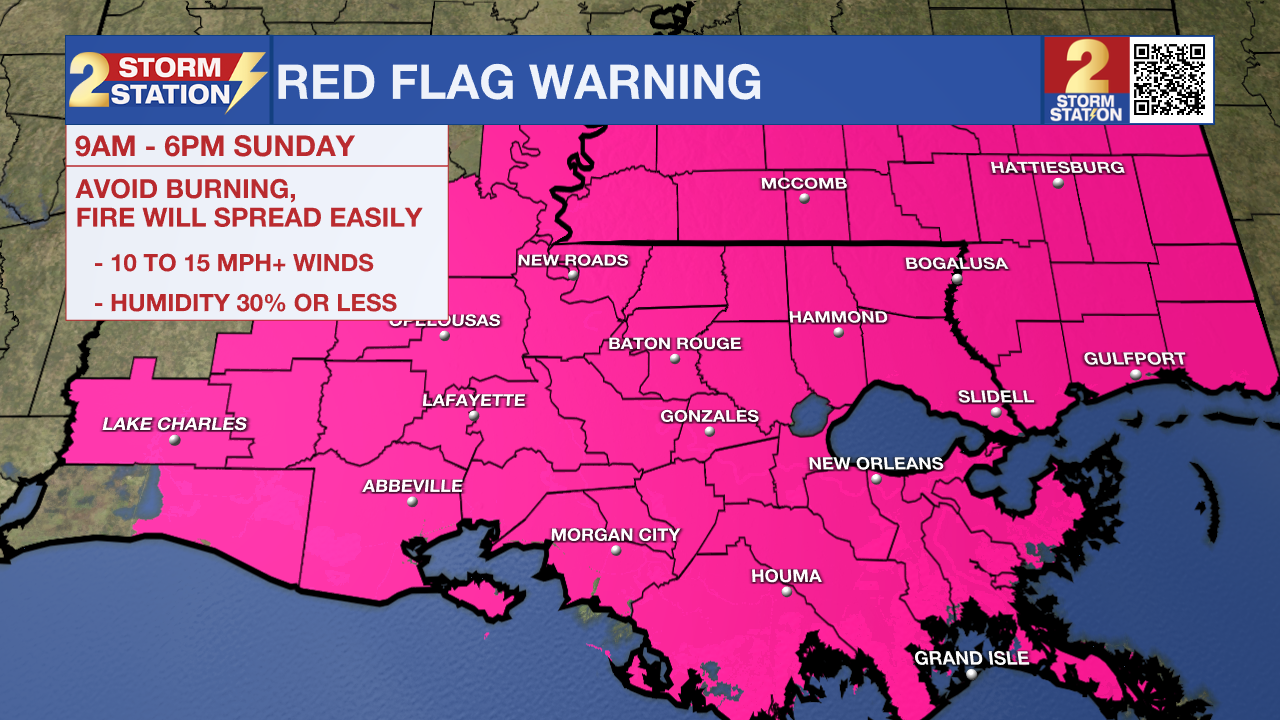
Today and tonight: Sunday will be noticeably cooler with highs struggling to reach around 60 under mostly sunny skies. Northwest winds will stay brisk through the day, occasionally gusting between 20 and 25 mph. With current dry conditions, low humidity, and gusty winds, fire danger will be present and a Red Flag Warning has been issued for the entire region. A Wind Advisory is in effect for areas south of Baton Rouge toward the coast.
Trending News
Tonight, temperatures drop as winds gradually ease. Lows will fall into the 30s with patchy frost, setting the stage for a cold start to the workweek.
Up Next: Cold air continues building in on Monday with highs remaining below normal. The coldest morning arrives on Tuesday, when freezing temperatures are likely north of the I-10/12 corridor, including the metro. Given the recent stretch of warm weather, some plants may be vulnerable. Temperatures begin moderating late week as winds shift and warmer air returns.
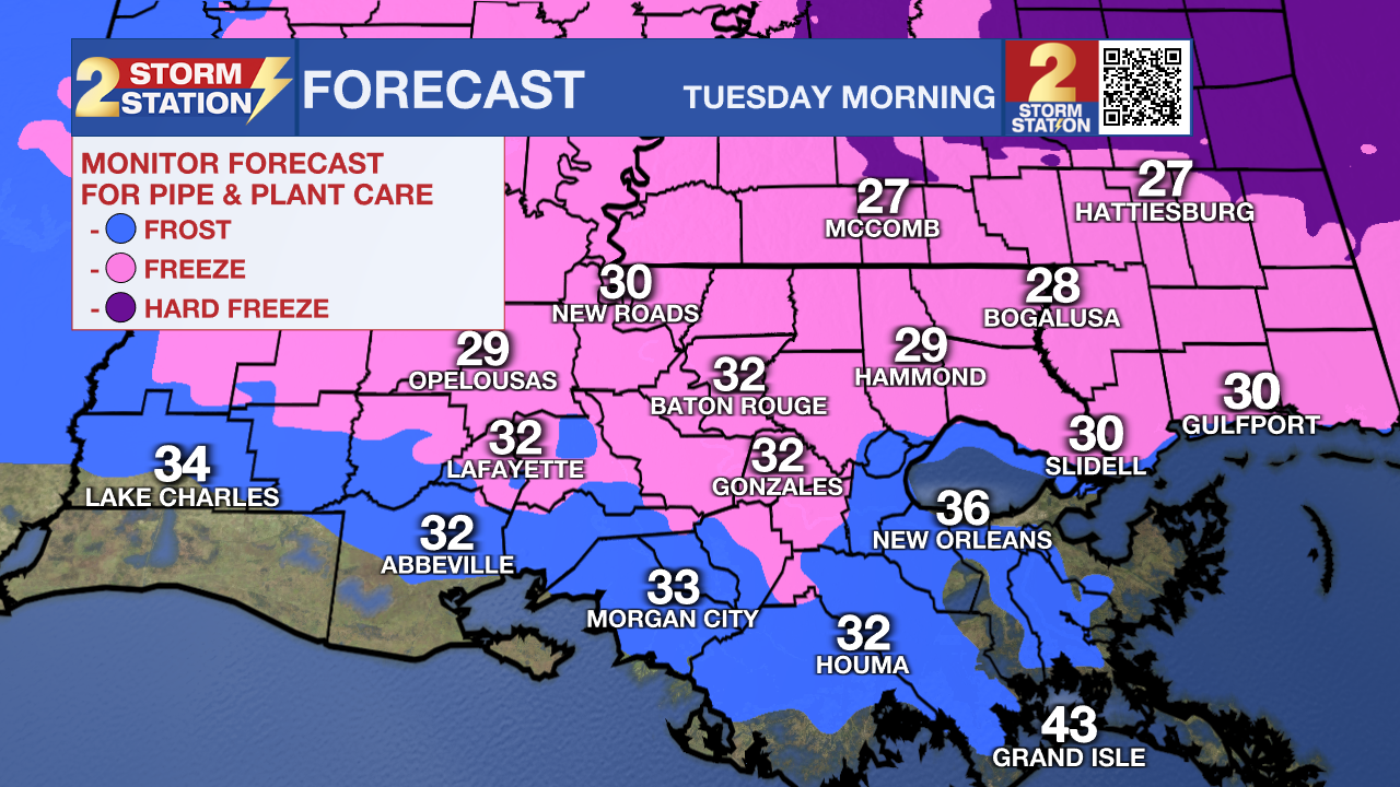
What to look out for: You’ll need a jacket today as temperatures run much cooler than what we’ve felt recently, and the gusty winds will make it feel even colder at times. Early next week, gardeners and anyone with sensitive plants should prepare for freezing temperatures by Tuesday morning, especially north of I-10. Now is a good time to think ahead about covering vegetation.
Get the latest 7-day forecast and real-time weather updates HERE.
Watch live news HERE.
– Dave
The Storm Station is here for you, on every platform. Your weather updates can be found on News 2, wbrz.com, and the WBRZ WX App on your Apple or Android device. Follow WBRZ Weather on Facebook and X for even more weather updates while you are on the go.
More News
