Saturday PM Forecast: no signs of significant cool down through mid-November
It's November in southeast Louisiana but it sure won't feel like it. Temperatures will remain well above average through all of next week. High and low temperature records will be threatened.
Tonight & Tomorrow: There continues to be the possibility for fog in the morning. One key condition for fog, is for the temperature and dewpoint to equal one another. Current dewpoints are in the middle 60's, and lows are forecasted to be in the upper 60's. We might struggle to get dewpoints to rebound high enough the equal the temperature. This seems to indicate only patchy fog development. The daytime hours will feel nothing like the fall. Highs will get into the upper 80's, with humidity making it feels over 90 degrees at times. A stray shower cannot be ruled out, but the vast majority will remain dry.
Up Next: Monday will be rinse and repeat in the world of weather. Conditions get a bit more interesting on Tuesday as a front approaches from the west. Unfortunately, the front will not pass, but it will get close enough for spotty to isolated storms on Tuesday and Wednesday. The rest of the week will remain unseasonably warm. Significant uncertainty exist at the end of the week and into the weekend. It all has to do with what effects a tropical disturbance currently located in the Caribbean has on the local area. (Go to tropics section for more details)
Get the latest 7-day forecast and real time weather updates HERE.
Watch live news HERE.
Trending News
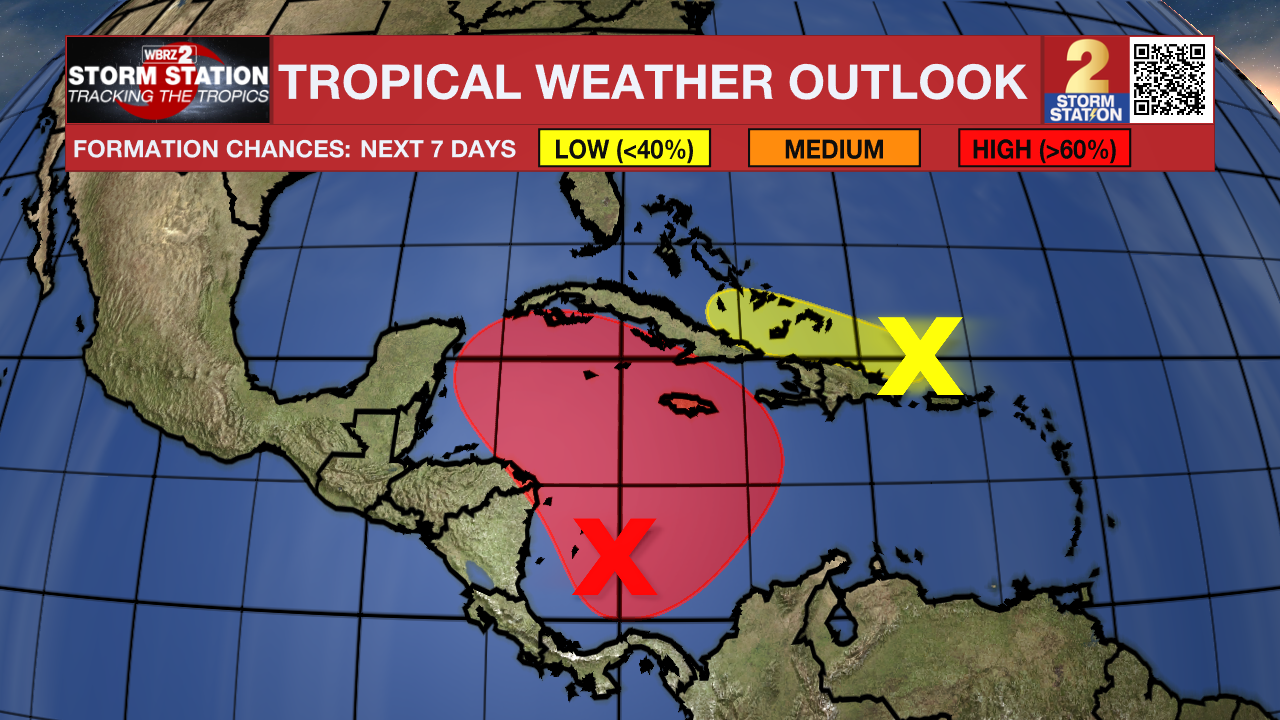
The Tropics: Odds continue to increase for development with a tropical disturbance located in the Caribbean. A tropical depression is likely to form in the coming days. Steering currents will likely drive this system north a first, before a ridge of high pressure steers it to the northwest. There seems to be a decent probability that some sort of disturbance gets in the southeastern Gulf of Mexico. Where it goes from there is highly uncertain. Please note that forecast uncertainty will remain high until we get an organized system.

A trough of low pressure just north of Puerto Rico and Hispaniola continues to produce disorganized showers and thunderstorms, and gusty winds. Slow development of this system is possible during the day or two while it moves westward near the Greater Antilles. By early next week, this system is expected to be absorbed into the low pressure area over the Caribbean Sea. Regardless of development, locally heavy rains are possible during the next couple of days across the northern Leeward Islands, Puerto Rico, Hispaniola, eastern Cuba and the southeastern Bahamas.

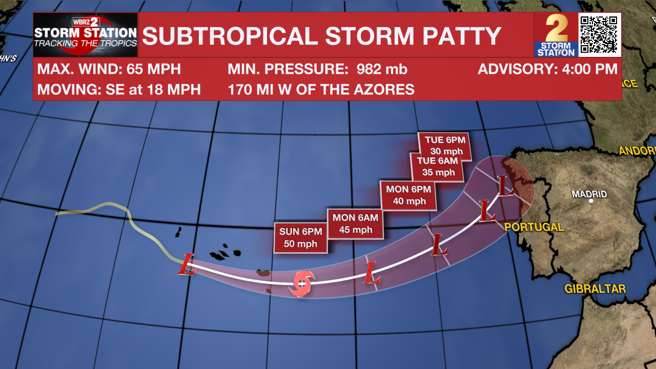
Subtropical Storm Patty has formed over the northern Atlantic. It has max sustained winds of 65 mph, and is moving SE at 18 mph. This system is expected to pass near or over the Azores this weekend. Patty is no threat to the United States.
– Balin
The Storm Station is here for you, on every platform. Your weather updates can be found on News 2, wbrz.com, and the WBRZ WX App on your Apple or Android device. Follow WBRZ Weather on Facebook and Twitter for even more weather updates while you are on the go.


