

Latest Weather Blog
Active afternoons, quieter nights
The pattern of active afternoons will press on through the weekend. Perhaps one benefit to the stormy weather is that thermometers have been kept from their usual perch in the 90s this time of year.
Next 24 Hours: The nighttime hours will be quieter than the afternoon though a shower or two remains possible. Low temperatures will bottom out in the low 70s. For Friday, there is not much new to say. High temperatures will warm into the mid 80s followed by a crop of scattered showers and thunderstorms.
It has been a while since we talked about rain coverage—the percentages on the forecast board often seen during the warm season. Here is a quick reminder about what those mean for the WBRZ Weather 13 Parish, 3 County forecast area.
10-30% - Isolated: a few locations receive measurable rain
30-60% - Scattered: part to half of the area receives measurable rain
60-100% - Widespread: almost all of the area receives measurable rain
Keep in mind, those chances tell nothing about timing. For instance, 100% DOES NOT mean it will rain all day. We will be sure to provide information in our forecasts as to when you can expect rain when chances are on the board. MORE: https://www.wbrz.com/news/a-chance-to-remember
Trending News
Up Next: The active pattern will continue into early next week. Scattered showers and thunderstorms are on the forecast board each day. Daily coverage may vary between 50 and 70 percent and afternoons should be the most active times though nights may not be exclusively dry. Moisture in the atmosphere will be well above average Sunday and Monday, so that 48-hour period will be worth particular attention for an uptick in the number of showers and thunderstorms, downpours and localized flooding. Through Wednesday, an additional 2-4 inches of rain is expected across the area but a locally higher total could occur if some spots are repeatedly hit with heavier thunderstorms. CLICK HERE for your full 7-Day Forecast.
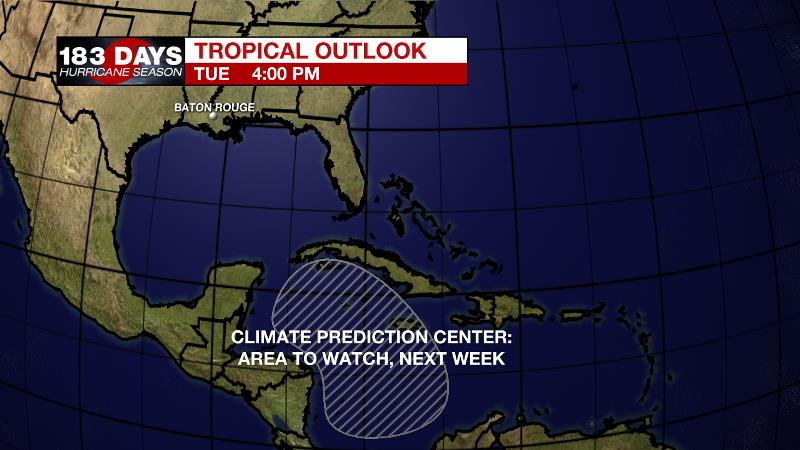
The Tropics: For the Gulf of Mexico, Caribbean Sea or Atlantic Ocean, no tropical development is expected over the next five days. However, the Climate Prediction Center has highlighted an area in the western Caribbean Sea that could provide favorable conditions for tropical development next week. Be sure to visit the WBRZ Hurricane Center as we navigate all 183 Days of Hurricane Season.
The Explanation: An upper level trough of low pressure will remain over east Texas through the weekend, keeping the local area beneath an active southwesterly jet stream. Overhead, the atmosphere will be cooler and unstable. Coupled with increasing moisture at the surface and ample heating, as is expected in June, and convection will have no problem developing each day. Any inland bound marine breezes and leftover outflow boundaries from previous storms will serve as focal points for convection. Scattered coverage is expected each day with the potentially for a few days to have widespread rain. While wind shear is often limited as we move into the warm season, very high instability and moisture can result in downpours and gusty wind so those hazards are possible with any stronger thunderstorms over the next week. Storm motions will be somewhat slow about 10-20mph so any vigorous cell could produce some street and poor drainage flooding. By Sunday, atmospheric moisture will climb even higher and persist into early next week. So, Sunday and beyond, thunderstorms are expected to become particularly efficient rainmakers. Though the 7-Day Forecast is for 2-4 inches of rain, locations that experience a few of these heavier thunderstorms could run into some totals over 6 inches. Still, spaced out over multiple days, that should not create any serious issues. Problems arise when we see 3 inches or more in a few hours time. There are finally some signs that daily coverage will wane toward the end of next week as the cool, unstable pocket aloft weakens.
--Josh
The WBRZ Weather Team is here for you, on every platform. Your weather updates can be found on News 2, wbrz.com, and the WBRZ WX App on your Apple or Android device. Follow WBRZ Weather on Facebook and Twitter for even more weather updates while you are on the go.
More News
