Some rain today, but no improvements to the drought monitor
Updated Drought Monitor
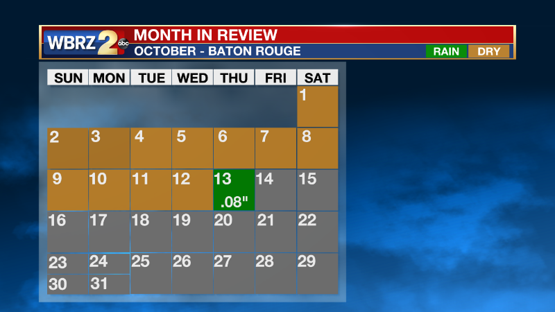
While we saw our first day of rain in over 33 days recorded at KBTR this morning. The drizzle did not improve the drought monitor at all, matter of fact, now more of the viewing area is under abnormally dry conditions and the severely dry conditions are creeping in.
Typically by this time of year, we have seen 49.80 inches of rainfall. So far for 2022, we have only seen 38.95 inches.
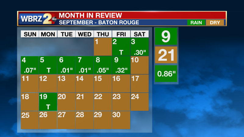
The dry spell extended from September 9th to October 12th. Areas around the viewing area may have picked up a few showers during this period, but official rainfall totals come from readings at KBTR. On September 19th KBTR picked up trace amounts of rain, which is not considered measurable rainfall.


The drought conditions are also impacting the Mississippi river. Here in Baton Rouge, an early 20th-century shipwreck was uncovered. For more details on the find click HERE.
Trending News
The Capital Area is not the only region seeing worsening drought conditions. Parts of the high plains and west coast are under exceptional drought conditions and areas in the Midwest are seeing similar drought conditions to our area. The east coast is still mainly free from drought conditions.
The upcoming forecast will not bring much relief to the drought monitor. Today only 0.08 inches of rain fell and the Storm Station is not tracking any more rain heading into the weekend. Your next shot for showers will come in late Sunday evening into Monday morning along the leading edge of a cold front. Click here to see the 7-day forecast.


