

Latest Weather Blog
Monday PM Forecast: Dodging pop-up storms all the way through Easter Weekend
A wetter weather pattern has returned, offering the chance to see showers and thunderstorms just about every day. The rain is needed, but it may be less than ideal ahead of the Easter holiday.
Tonight & Tomorrow: Remaining showers will quickly taper after dark, leading to a few hours of partial clearing before clouds increase again overnight. Expect a muggy start to Tuesday with temperatures starting off in the mid-60s. Don’t be surprised to come across a spotty shower either during the drive into work. Another crop of scattered showers and thunderstorms will develop as early as midday and persist into the afternoon. There will be plenty of dry time, but still keep an umbrella close by. Roughly 60% of the Capital Area will experience a brief downpour at some point during the day. Highs should reach the low 80s, although rain-cooling showers might keep temperatures a touch cooler in a few neighborhoods.

Up Next: The wet pattern will remain in place through the end of the week. While rain won’t hit every specific location daily, scattered showers and storms will be out there each afternoon. No single day appears to be a washout, though some will be wetter than others. Thursday may prove to be the most active day of the period, with an upper-level disturbance set to trigger additional showers and thunderstorms. Collectively over the next week, most areas can expect 1-3” of rain with isolated higher totals possible. Severe weather and flash flooding won’t be a major concern. That said, a particularly heavy storm could lead to gusty winds and/or ponding on the roadways in localized areas.
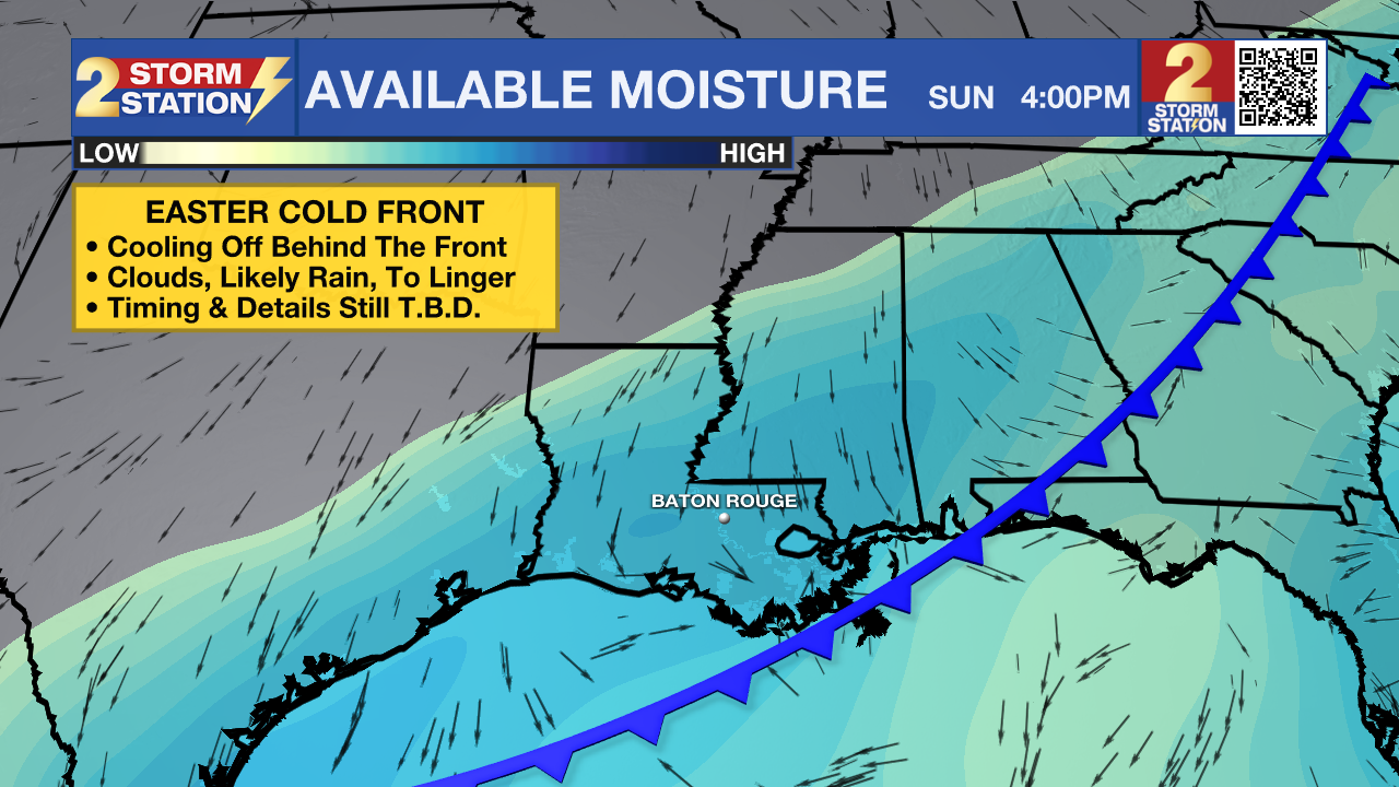
Easter Weekend: The same warm and stormy pattern will persist through much of Easter Weekend. By Easter Sunday, there will be a cold front in play as well. Confidence has increased that this front will result in a cooler Easter holiday, but there will be plenty of lingering moisture. The most likely result is a cooler, dreary, and damp Sunday. If planning a crawfish boil, cookout, egg hunt, or any outdoor time with family, definitely have an indoor backup option in case rain and storms threaten. Keep in touch with the Storm Station as more information comes in.
Trending News
Get the latest 7-day forecast and real-time weather updates HERE.
Watch live news HERE.
— Meteorologist Malcolm Byron
The Storm Station is here for you, on every platform. Your weather updates can be found on News 2, wbrz.com, and the WBRZ WX App on your Apple or Android device. Follow WBRZ Weather on Facebook and X for even more weather updates while you are on the go.
More News
