

Latest Weather Blog
Friday AM Forecast: heat alerts return, chance for needed rain early next week
Humidity will slowly but surely return to the area as we move into the weekend. By next week, a tropical wave and associated moisture may provide a better chance for some showers and thunderstorms—especially south of the interstates.
Friday, as an upper-level ridge strengthens and moves over the Bayou State, atmospheric mixing will be reduced, and sunny, hot conditions will persist. These conditions will promote ground-level ozone formation. In addition, calm to light winds through most of the period will limit pollutant dispersion. Therefore, an ***Air Quality Alert*** is in effect as conditions will be unhealthy for sensitive groups. Active children and adults, the elderly and people with respiratory diseases, such as asthma, should avoid prolonged outdoor activities and exertion.
A ***HEAT ADVISORY*** is in effect from 11 am to 8 pm Friday. Heat index values up to 112 expected. Hot temperatures and high humidity may cause heat illnesses to occur. Drink plenty of fluids, stay in an air-conditioned room, stay out of the sun, and check up on relatives and neighbors. Young children and pets should never be left unattended in vehicles under any circumstances.
Today and Tonight: As the workweek ends, temperatures will max out around 100 degrees under sunny skies, but feels like temperatures could reach near 112 degrees. It will also be another mostly dry day with less than 10% of the viewing area seeing any rainfall. The humidity will be back and noticeable overnight as low temperatures only slip into the upper 70s.
Up Next: The weekend is looking to be a hot one. This will likely necessitate the need for heat alerts once again. By Monday, a fast moving tropical wave will send a plume of moisture from east to west across the Gulf of Mexico. Depending on the exact track of this pocket of moisture, there may be an uptick in showers and thunderstorms early in the week, especially for coastal areas. By Wednesday, extremely hot temperatures will be back in the forecast. In fact, it is possible that air temperatures could reach even higher than they have at any point during this sultry summer. The so-called heat dome looks even more intense than previous weeks and the extremely dry soil conditions will also contribute to very hot temperatures.
Trending News
Get the latest 7-day forecast and real time weather updates HERE.
Watch live news HERE.
The Tropics: Disorganized showers and thunderstorms continue in association with an elongated trough of low pressure about 1000 miles west-southwest of the Cabo Verde Islands. Environmental conditions appear conducive for gradual development of this system, and there is a sixty percent chance that a tropical depression could form during the next several days while it moves west-northwestward at 10 to 15 mph across the central tropical Atlantic.
A broad area of low pressure associated with a tropical wave is producing a large area of disorganized showers and thunderstorms near and to the southwest of the Cabo Verde Islands. Further development of this low is possible while it moves toward the west-northwest or northwest at around 10 mph across the eastern tropical Atlantic, and there is a sixty percent chance that a tropical depression could form over the weekend before environmental conditions become unfavorable for development early next week.
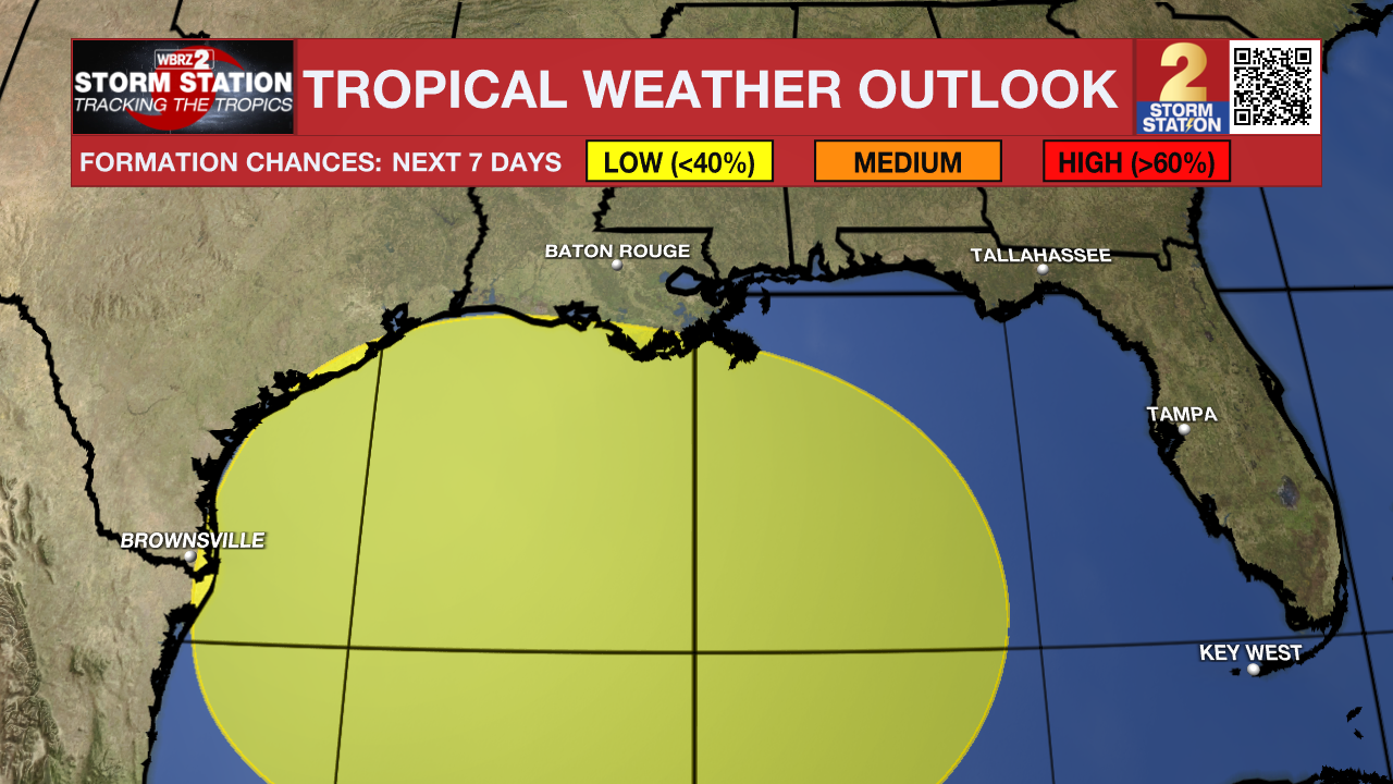
A broad area of low pressure could form in the central or western Gulf of Mexico by the beginning of next week. Some slow development of this system is possible thereafter as it moves westward and approaches the western Gulf of Mexico coastline by the middle of next week.
--Keller
The Storm Station is here for you, on every platform. Your weather updates can be found on News 2, wbrz.com, and the WBRZ WX App on your Apple or Android device. Follow WBRZ Weather on Facebook and Twitter for even more weather updates while you are on the go.
More News
