

Latest Weather Blog
Few rinsing on repeat, drier conditions soon
Isolated to scattered showers and thunderstorms will remain in the forecast through the workweek. By the weekend, a drier trend will emerge but that will also lead to warmer temperatures.
THE FORECAST:
Today and Tonight: Showers and thunderstorms will isolated around the area on Thursday and, as usual, one or two could produce downpours or gusty wind. The best chance looks to be north of I-10. Otherwise, partly sunny skies will allow high temperatures into the mid 80s. The overnight hours will be mostly cloudy with lows in the upper 60s, and as a weak cold front approaches the area, a few showers and thunderstorms are possible.
Up Next: An upper level low and associated cold front will move across the local area Friday. With that occurring, there will be enough instability and lift available for scattered showers and thunderstorms. However, once this system moves farther east over the weekend, humidity will fall to more comfortable levels for a few days. So while afternoons will stay warm, mornings and evenings will not feel too bad. Departing instability and lift will substantially trim rain coverage through Tuesday.
Trending News
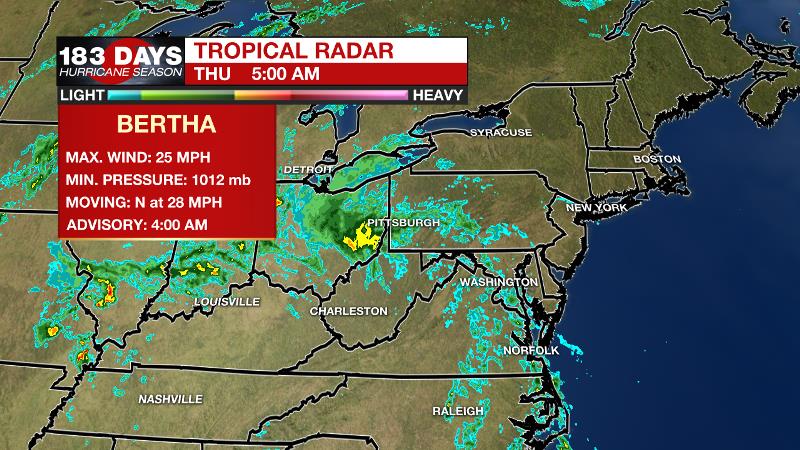
The Tropics: Tropical Storm Bertha formed near the coast of South Carolina just after 7am CT Wednesday morning and made landfall just under two hours later near Charleston. The storm has now become post-tropical and will bring rain to the Ohio Valley on Thursday.
THE EXPLANATION:
An upper level low swirling over the local area will continue to instigate isolated to scattered showers and thunderstorms. Rain coverage was lower than expected on Wednesday and with the same type of air mass in place, there is no reason to believe Thursday will play out to be significantly different. A piece of energy rotating around the upper level low may help to initiate convection but again, that was not enough for more than isolated activity Wednesday. The best chance for rain will be around midday north of I-10. Perhaps an approaching cold front will aid development overnight and into Friday, especially south of I-10. Any storms will be capable of downpours and gusty wind. By Friday night, the upper level low will start to move through our region and into the eastern U.S. This will drag a weak surface front through the region allowing dew points to drop to more comfortable levels for a few days. So while afternoons will stay warm, mornings and evenings will not feel too bad. Departing instability and lift will substantially trim the rain coverage. A ridge will build into the region from the west on Sunday or Monday providing a much warmer and drier atmosphere. This would lead to much warmer temperatures and lower rain coverage.
--Josh
The WBRZ Weather Team is here for you, on every platform. Your weather updates can be found on News 2, wbrz.com, and the WBRZ WX App. on Apple and Android devices. Follow WBRZ Weather on Facebook and Twitter for even more weather updates while you are on the go.
More News
