Beaut' at the box, humidity rising
As a surface high pressure weakens and pushes east beneath an eastward moving upper level ridge, more mixing of the local atmopshere has allowed the Department of Environmental Quality to drop the air quality alert. As far as the rest of "weather and health," keep applying sunscreen, with a U.V. index of 11, sunburn times will be under 10 minutes!
THE FORECAST:

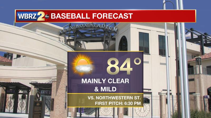
Today and Tonight: Another warm afternoon is ahead with high temperatures climbing into the upper 80s. Continued light, southerly winds will promote a subtle increase in humidity. At 6:30 this evening, first pitch goes out between LSU and Northwestern St. at Alex Box Stadium. While it may be a little muggy, clear and quiet conditions are expected. Skies will be clear early with some patchy fog developing into the morning hours with low temperatures in the upper 60s.

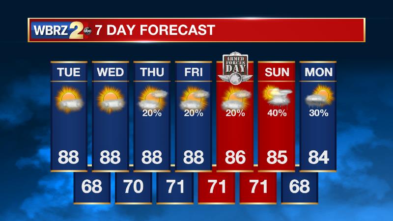
Up Next: From the middle of the week and beyond, increasing humidity will be noted each day as morning temperatures fail to leave the 70s. Fog will therefore be possible each morning as well. The increased moisture may also result in pop up showers and thunderstorms Thursday through Saturday. The weather will otherwise be consistent with partly sunny afternoons and high temperatures in the upper 80s. Some numbers may peak near 90.
THE SCIENCE: An area of high pressure will persist across the Southeast U.S. through Tuesday as an upper level ridge begins to slide east. As a result, another dry and mainly clear day is expected. The upper ridge axis will be over the Eastern U.S. by Wednesday and the trailing trough will result in a faster, southwesterly, divergent flow aloft. In addition to this, cooler temperatures aloft should allow isolated showers and thunderstorms to develop by Thursday, Friday and Saturday. Rain coverage should not exceed 20 percent. Meanwhile, a continued southerly surface wind will promote a gradual increase in humidity through the weekend. This will be most noticeable in low temperatures which will climb into the low 70s. Some fog could potentially form as well. On Sunday, the axis of an upper trough will move across the Upper Mississippi River Valley and may drag a weak cold front through the area. Increased rain coverage may result for the second half of the weekend.
Trending News
--Josh


