

Latest Weather Blog
Monday morning video forecast
Related Story
A strong cold front moved through this morning, bringing gusty winds and sharply colder air. Clouds will gradually clear, but it will be blustery and cold, with freezing temperatures and dangerous wind chills possible by Tuesday morning.
.png)
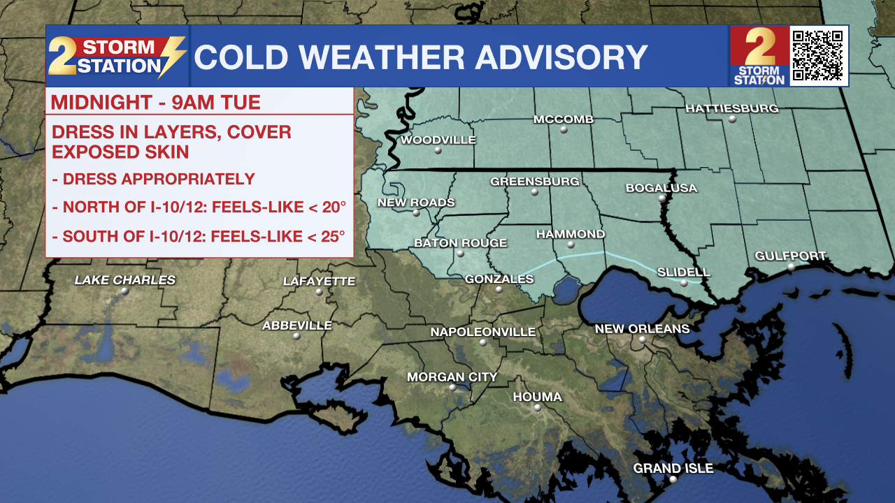
Today and tonight: A strong cold front is sweeping through the area this morning, bringing gusty north winds that will increase through the late morning and afternoon. A WIND ADVISORY is in effect. Any early showers will clear quickly, followed by falling temperatures and much drier air. By this afternoon, winds of 20–25 mph with higher gusts will make it feel significantly colder. Tonight will be clear and cold, with lows dropping into the low 30s and wind chills falling into the 20s. A COLD WEATHER ADVISORY will be in effect tonight through Tuesday morning.
Up Next: Cold air remains firmly in place Tuesday as high pressure settles in. Afternoon temperatures will struggle to climb out of the 40s to near 50 degrees, despite sunshine. Winds will be lighter, but the air mass will remain cold and dry. Tuesday night looks to be the coldest of the stretch, with many inland areas falling below freezing, especially away from the immediate coast.
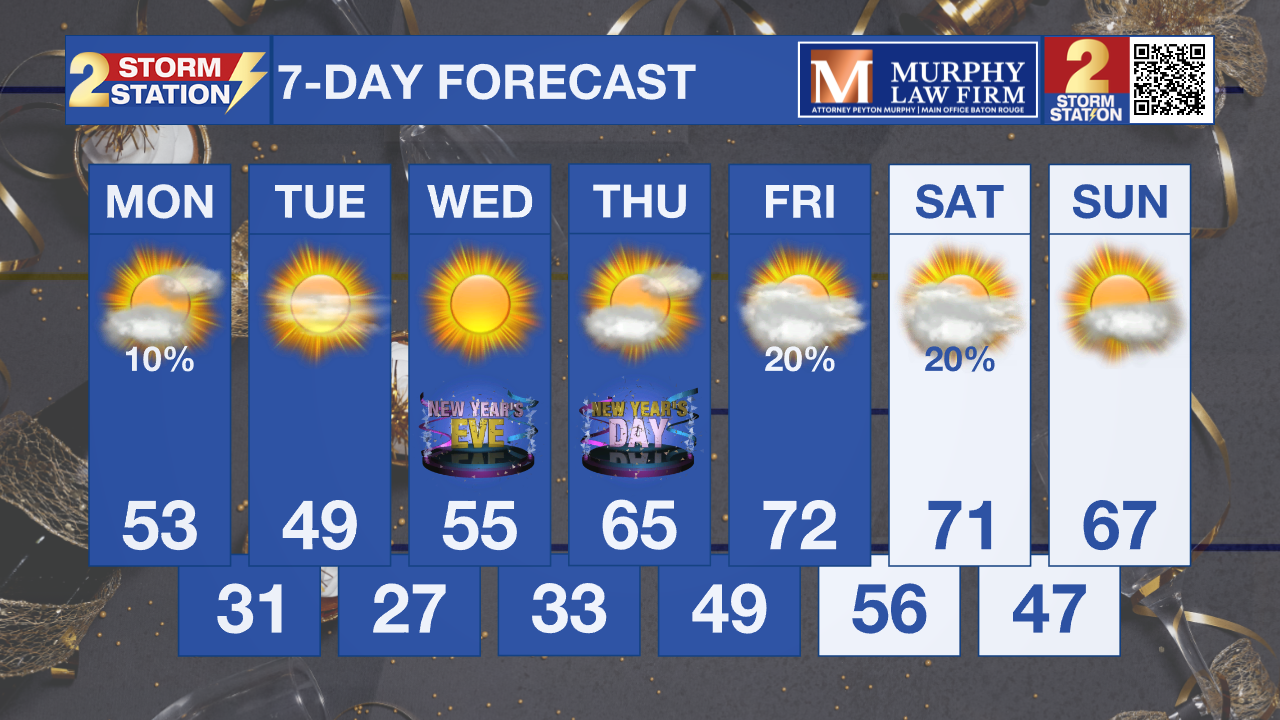
What to look out for: Freezing temperatures are likely late Monday night into Tuesday morning, particularly north of the I-10/12 corridor. Wind chills early Tuesday could dip into the 20s, making it feel even colder. Fire weather concerns may develop Monday afternoon due to gusty winds, low humidity, and drying conditions behind the front. A slow warming trend begins midweek, with temperatures moderating by Thursday and heading back toward the 60s.
Get the latest 7-day forecast and real-time weather updates HERE.
Watch live news HERE.
– Dave
The Storm Station is here for you, on every platform. Your weather updates can be found on News 2, wbrz.com, and the WBRZ WX App on your Apple or Android device. Follow WBRZ Weather on Facebook and X for even more weather updates while you are on the go.
News
