Wednesday AM Forecast: After cooldown, temperatures rise ahead of our next storm system
Our coldest night has yet to arrive this week. That will come on Thursday morning, where some areas of frost are possible. Some areas north and east of Baton Rouge might even near the freezing mark. Temperatures rebound thereafter ahead of our next cold front. That front could bring some thunderstorms through the capital region.
Today & Tonight: Cloud cover has helped keep temperatures slightly warmer early Wednesday. Even so, we’re still dealing with mid to upper-40s in the metro area. You’ll want the jackets as you head out in the morning. Any remaining high clouds will exit as the morning progresses, and we’ll see full sunshine on Wednesday afternoon. A slight northerly breeze will drive colder air into the region. As a result, we expect a cooler day with highs in the low-60s in Baton Rouge.
We will keep mostly clear skies on Wednesday night. Couple that with light winds and low humidity, and we have a recipe for a cold night. We’re forecasting a low near 36° in the capital city. Communities outside of the city and north of the interstate may inch closer to the freezing mark. We'll likely see areas dealing with frost early Thursday, so it may be good idea to cover up the plants or bring them inside.
Up Next: After a very cold start on Thursday, temperatures will gradually rebound leading up to our next cold front this weekend. Temperatures will top out in the upper-70 to near 80° on Saturday, and you’ll notice muggy air returning. This will serve as ample storm fuel as the cold front passes on Saturday evening.
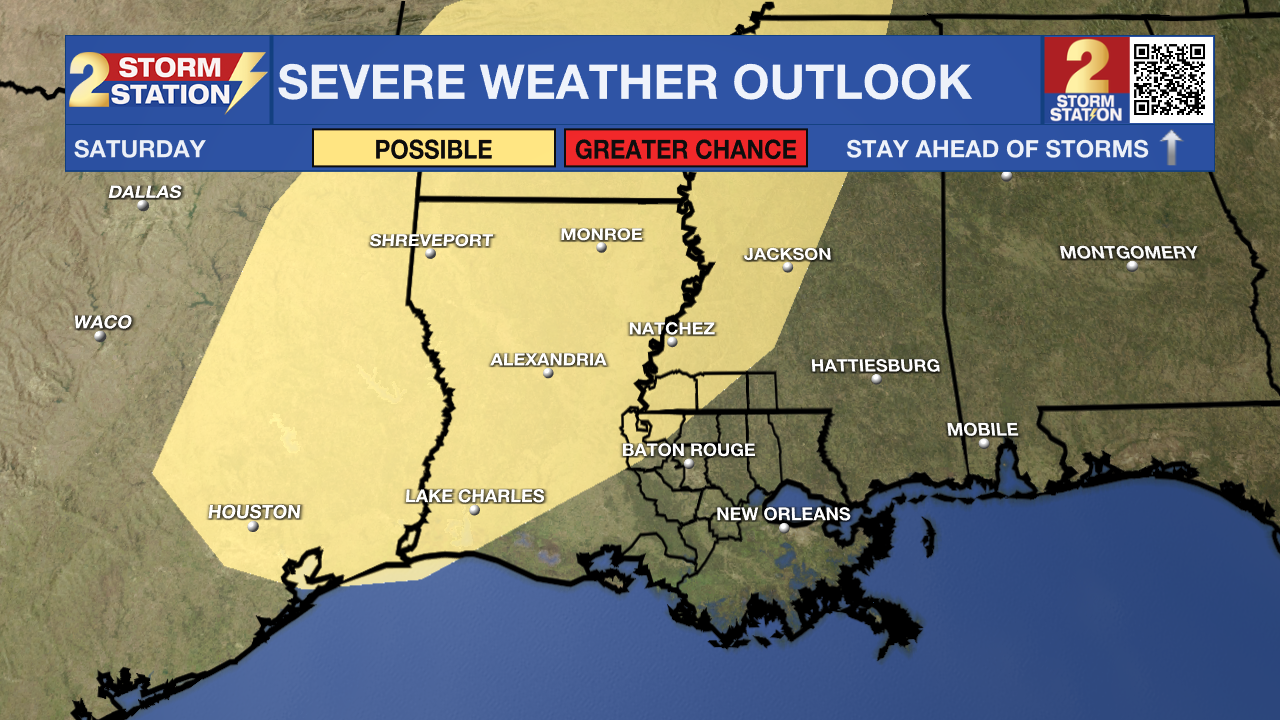
The Storm Prediction Center is still watching all of central and northern Louisiana for a severe weather risk on Saturday. This area includes portions of Pointe Coupee/West Feliciana parishes and Wilkinson/Amite counties. While this does not include Baton Rouge, the ingredients might still come together for a few strong storms. Be sure to check in with the Storm Station each day for the latest updates on the storm system.

Behind this front, we’ll end up much cooler for the second half of the weekend. We’ll likely see some more chilly starts early next week.
Trending News
-- Meteorologist Malcolm Byron
Get the latest 7-day forecast and real time weather updates HERE.
Watch live news HERE.
The Storm Station is here for you, on every platform. Your weather updates can be found on News 2, wbrz.com, and the WBRZ WX App on your Apple or Android device. Follow WBRZ Weather on Facebook and Twitter for even more weather updates while you are on the go.


