

Latest Weather Blog
Thursday PM Forecast: fog to fire danger next two days, then rain returns
After a long stretch of dry and quiet weather, the pattern is starting to change. A cold front will bring a brief dip in temperatures for the weekend before rain chances return next week.
Dense Fog Advisory: The National Weather Service has issued a DENSE FOG ADVISORY for portions of southeast Louisiana and south Mississippi, in effect from 1 AM to 9 AM Friday. Visibility may decrease to one-quarter mile or less. Be sure to exercise caution on the roads, especially near ongoing marsh fires, where super fog could form and reduce visibility to near zero.
Fire Weather Watch: The National Weather Service has also issued a FIRE WEATHER WATCH for portions of southeast Louisiana and south Mississippi, in effect from Saturday morning through Saturday evening. A much drier air mass, gusty northwesterly winds of 10 to 15 mph, and relative humidity values as low as 20 to 25 percent will combine to create conditions favorable for the development and rapid spread of wildfires. Use extreme caution with any ignition sources and be aware of any burn bans in your area.

Trending News
Friday: morning fog, afternoon warmth
Weekend: cooler and drier, critical fire weather
Early Next Week: showers become possible
Tonight & Tomorrow: As has been the case recently, the first half of the night will be mostly clear. Low temperatures will settle into the upper 50s and low 60s a few hours before dawn. As this occurs, some fog and low clouds will develop—the low clouds primarily where winds are just beyond calm. After a gray morning commute, the sun will break through for another afternoon of above-average warmth. High temperatures will climb into the upper 80s, perhaps just a few degrees shy of records. This will be the last "well above average" day, as a cold front will move through Friday night. While the cold front might bring little to no rainfall, it will usher in more seasonal temperatures for the weekend.
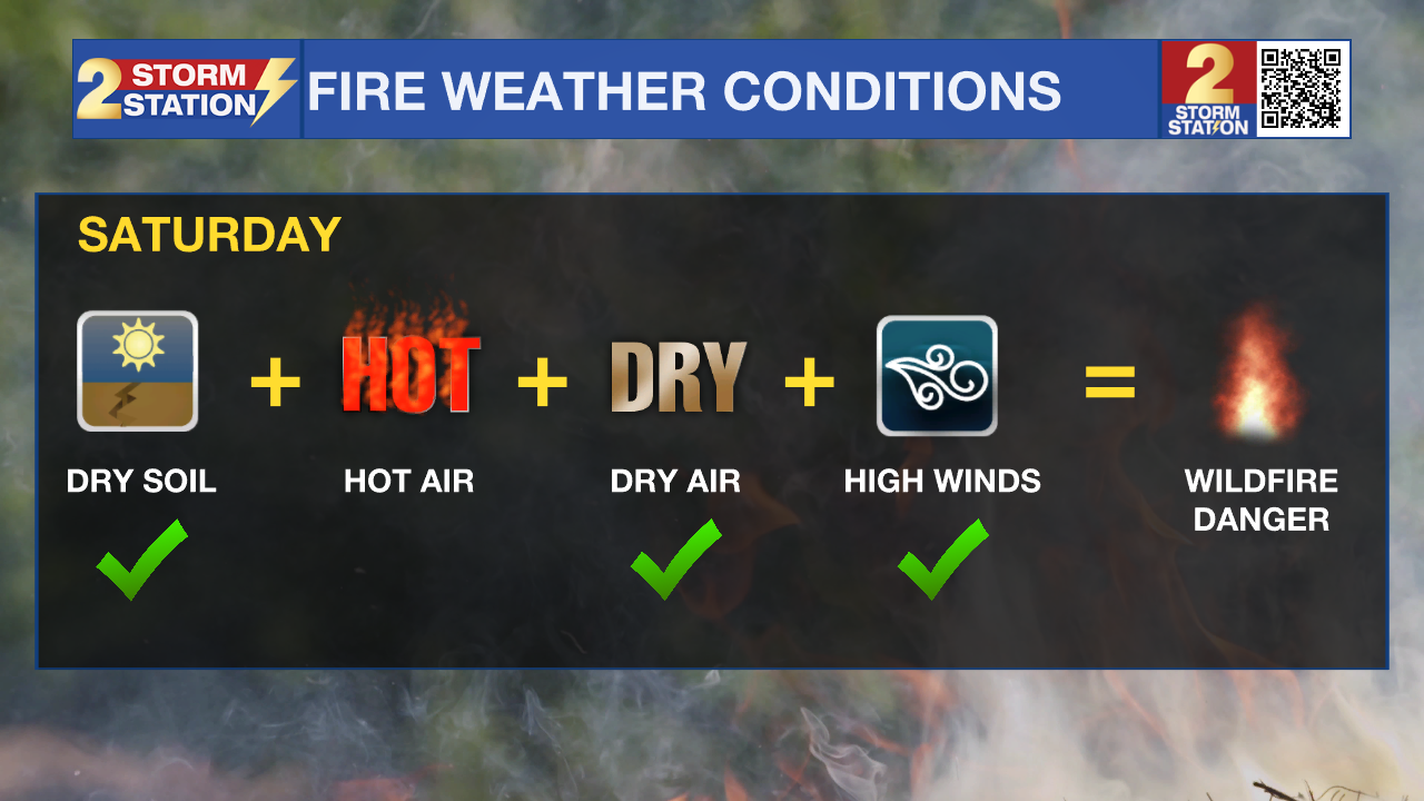
Up Next: On Saturday, a drier air mass will move into the region from the north following a cold front. This will lead to much lower humidity values and occasionally gusty winds, creating critical fire weather concerns (see the Fire Weather Watch section above for more details). Beyond that, expect plenty of sunshine and a pleasant day with highs in the mid-70s.
Sunday will return warmer and more humid conditions. There is a small chance for a spotty, light shower as moisture increases. The afternoon will be partly sunny with highs in the upper 70s and low 80s.
The new workweek will have isolated showers and thunderstorms possible each day. There are no signs of an organized storm system, so no washouts are expected, and any precipitation will be “passing” in nature. It is unlikely that any one location will get rain each day, and amounts will stay very manageable—in fact, any rain will likely be considered beneficial. Temperatures will be back above seasonal averages with highs in the low 80s and lows in the low 60s.
Get the latest 7-day forecast and real-time weather updates HERE.
Watch live news HERE.
– Josh
The Storm Station is here for you, on every platform. Your weather updates can be found on News 2, wbrz.com, and the WBRZ WX App on your Apple or Android device. Follow WBRZ Weather on Facebook and X for even more weather updates while you are on the go.
More News
