Strong storms, heavy rain possible through Monday
A strong storm system will bring the risk of flooding, tornadoes and gusty wind to the central Gulf Coast Sunday into Monday. Those in the forecast area should be reviewing preparedness and safety plans for flooding and severe weather. An area of showers and thunderstorms will develop late Sunday and rain could fall heavily at times overnight into Monday morning. A combination of moisture, lift and strong low-level wind fields will create an environment favorable for torrential rain and tornadoes. A cold front will sweep through the region by Monday afternoon, ending the risk from west to east.
Outlooks and Alerts:
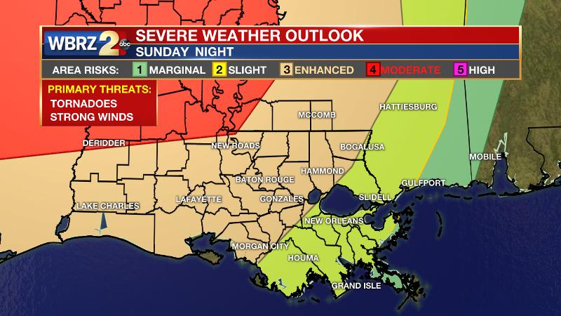
The National Weather Service (NWS) Storm Prediction Center (SPC) has portions of northwest Pointe Coupee Parish and Wilkinson County in a 4/5 “moderate risk” for severe weather, areas northwest of a Morgan City-Baton Rouge-McComb line in a 3/5 “enhanced risk” for severe weather and the remainder of the region in a 2/5 “slight risk” for severe weather.
The NWS Weather Prediction Center (WPC) has Wilkinson County, East and West Feliciana Parishes, East and West Baton Rouge Parishes, Pointe Coupee Parish, and Iberville Parish in a 3/4 “moderate risk” for excessive rainfall and the remainder of the area under a 2/4 “slight risk” of excessive rainfall. ((RAIN MAP))
Trending News
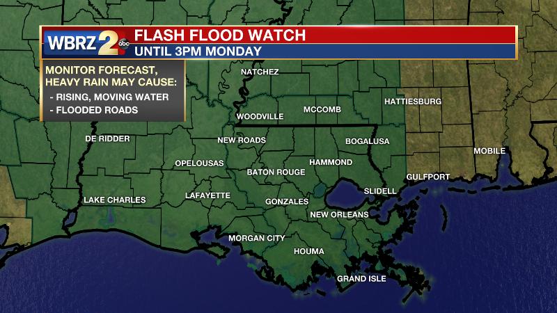
A *FLASH FLOOD WATCH* is in effect until 3pm Monday for the entire WBRZ Weather Forecast area. 3-6 inches of rain is expected with locally higher amounts possible. The WPC says, “There has been great uncertainty as to the Placement of heaviest rainfall, but the signal in the global models leading up to the event has been quite strong at times, with 24-hour amounts greater than 5 inches.” With an atmosphere containing twice the normal moisture for this time of year, isolated totals of up to 8 inches could occur where the heaviest bands of rain become established.
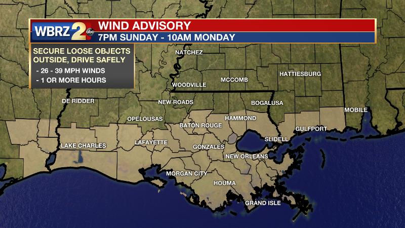
A *WIND ADVISORY* will begin at 7 pm Sunday through 10am Monday for areas along and south of I-12. Sustained winds of 25mph are expected with higher gusts possible.
A *COASTAL FLOOD ADVISORY* will begin at 1pm Sunday through 7pm Monday for most coastal counties and parishes as tides should rise to 1 to 2 feet above normal.
Possible Threats:
- Tornadoes – intense storm cells may spin up a tornado
- Flash Flooding – 3 to 6 inches of rain with isolated amounts over 8 inches
- Damaging Wind – possibly in excess of 58mph
- Large Hail – could exceed 1 inch in diameter in the strongest storms
Estimated Timeline: Showers and thunderstorms will be possible as early as Sunday Afternoon. Through evening, while thunderstorms are isolated to scattered, is when the greatest threat for severe weather will exist. Overnight, as activity becomes more widespread, the storm system will transition into a heavy rain event.
Impacts: Severe weather may interfere with Sunday Evening plans such as outdoor events, dinner arrangements and family gatherings. Be aware of the weather situation before venturing out. Heavy rain and street flooding could significantly affect the Monday Morning commute. Check for local road closures and DO NOT drive your car across a flooded street if you come across one. Runoff may cause area rivers to rise early next week. For water levels along the Amite, Comite, Tangipahoa, Tchefuncte and Tickfaw Rivers, CLICK HERE.
Tornadoes are capable of destroying well-made structures, uprooting trees, and creating flying debris. Strong wind is able to break off large branches, knock over trees or cause structural damage to trees. Large hail can damage property such as plants, roofs and vehicles. Mobile homes are not safe structures in a tornado and can be blown easily. Being outdoors or near windows during high winds can leave you vulnerable to be struck by flying debris. Driving in hail can cause your windshield to shatter creating a high risk for injury.
Actions: Have a plan and know where you will go if a tornado warning is issued for your area. If you live in a mobile home, be sure you have quick access to a sturdy building while the threat is ongoing. Move valuables under a sturdy shelter. Tie down loose objects. Have access to watches and warnings such as with a NOAA Weather Radio or from the WBRZ Weather Team on Facebook and Twitter. Additionally, the *free* WBRZ WX App. sends push notifications to Apple and Android devices if a watch or warning is issued for your location. Remember, a watch means “conditions are favorable, and a particular threat could develop” and a warning means that “threat is happening and you should take action immediately.” For much more detailed severe weather safety, CLICK HERE.
*some users have reported issues opening the WBRZ WX App. on iPhone. Please uninstall and reinstall and this should correct the problem.
Some Weather Extras:
After 1.5 – 4.5 inches of rain fell across Southeast Louisiana and Southwest Mississippi on Thursday, the ground is saturated and rivers will rise as runoff continues this weekend. As the storm system evolves, moisture in the atmosphere is forecast to increase to record levels, more than double the normal level for this time of year. As a result, very efficient rainfall processes will occur.
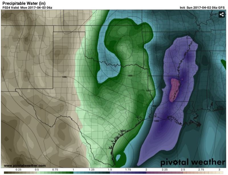
Precipitable Water: a measure of the moisture content in the atmosphere, normal for early April is near 1.25" | Image via Pivotal Weather valid at 1am Monday
For the third time in 8 days, the risk of severe weather is also on the table. Once again, instability is expected to be high enough to support severe thunderstorms. However, unlike the previous two events (Saturday and Thursday), the surface low pressure system is expected to take a track much closer to the local area which increases low-level wind shear and therefore the ability for thunderstorms to rotate. At least through Sunday evening, at which point shear and instability will begin to decrease, there is some risk for tornadoes as well.
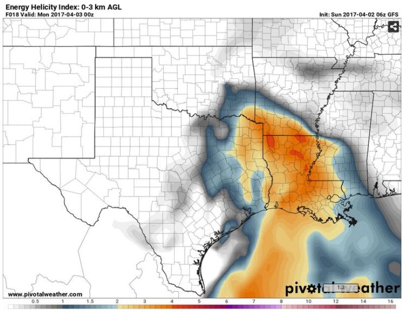
Energy Helicity Index: a combination of instability and wind shear to identify tornado possibility (values over 2 considered significant) | Image via Pivotal Weather, valid at 7pm Sunday


