

Latest Weather Blog
Scattered showers and thunderstorms will not back down just yet
In June, we know that steamy and sticky feel that comes without showers and thunderstorms. Dry areas should have no problem reaching the 90s in the days ahead.
Next 24 Hours: Any evening showers or thunderstorms will fizzle during the overnight hours. Beneath partly cloudy skies, low temperatures will bottom in the mid-70s, keeping a very muggy feel outside. On Wednesday, partly sunny skies will guide high temperatures into the upper 80s and low 90s. Scattered showers and thunderstorms are expected in the afternoon and evening with perhaps a bit more coverage than Monday or Tuesday. Storms should not be very long-lived, so no significant issues are expected but brief downpours and gusty wind are always possible with warm season boomers.
It has been a while since we talked about rain coverage—the percentages on the forecast board often seen during the warm season. Here is a quick reminder about what those mean for the WBRZ Weather 13 Parish, 3 County forecast area.
10-30% - Isolated: a few locations receive measurable rain
30-60% - Scattered: part to half of the area receives measurable rain
60-100% - Widespread: almost all of the area receives measurable rain
Keep in mind, those chances tell nothing about timing. For instance, 100% DOES NOT mean it will rain all day. We will be sure to provide information in our forecasts as to when you can expect rain when chances are on the board. MORE: https://www.wbrz.com/news/a-chance-to-remember
Trending News
Up Next: Thursday is a tricky forecast. Indications are that the area should begin to trend drier but we will have to monitor and area of showers and thunderstorms well to the north that could surge south into the local area late in the day. Otherwise, the number of showers and thunderstorms in the forecast area should decline and stay in the stray or isolated category right on through Saturday. A warmer and more stable atmosphere should provide a change in fortune for saturated, rain weary areas. The partly sunny skies will easily allow temperatures to reach 90 degrees or higher. Nights will be still and sticky, in the low to mid 70s. Onward from Sunday, token 30 percent rain chances will be carried as the area looks to lock into a typical summer pattern. CLICK HERE for your full 7-Day Forecast.
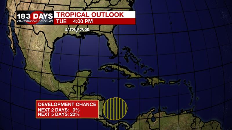
The Tropics: A broad trough of low pressure is expected to develop over the southwestern Caribbean Sea over the next few days. As the system moves slowly northwestward toward Central America, there is a 20 percent chance of tropical formation over the next 5 days. Be sure to visit the WBRZ Hurricane Center as we navigate all 183 Days of Hurricane Season.
The Explanation: On Wednesday, the same a continuously weakening upper level trough will remain northeast of the local area. A final push of energy in the atmosphere associated with the center axis of the trough could serve as a trigger for a bit more convective development that what was observed Monday and Tuesday. Both instability and moisture will be in ample supply should this extra trigger come into play. That being said, the loss of daytime warming will lead to a repaid decay in showers and thunderstorms after sunset. Beginning on Thursday, a strong upper level ridge over Mexico and the Central U.S. will start to broaden across the country. This will gradually bring a lowering of daily rain coverage through the end of the week and that trend will continue over the weekend as the ridge builds overhead. One caveat is that some forecast model guidance is hinting that a band of showers and thunderstorms that develops well north of our area, could swing into town Thursday afternoon. This could lead to an uptick in rain coverage, but for now, we are holding on to a drier outlook. Of course, a lack of rain will push high temperatures back into the seasonably hot low 90s. By the end of next weekend, or early next week, an upper level trough moving out of Canada will swoop south and dampen the ridge leading to a return of more typical, afternoon showers and thunderstorms.
--Josh
The WBRZ Weather Team is here for you, on every platform. Your weather updates can be found on News 2, wbrz.com, and the WBRZ WX App on your Apple or Android device. Follow WBRZ Weather on Facebook and Twitter for even more weather updates while you are on the go.
More News
