

Latest Weather Blog
Saturday Forecast: Heat Wave Returns - Rain Chances Bring Relief
Another extremely hot day as temperatures will begin to approach the upper 90s with the heat index in the 100s
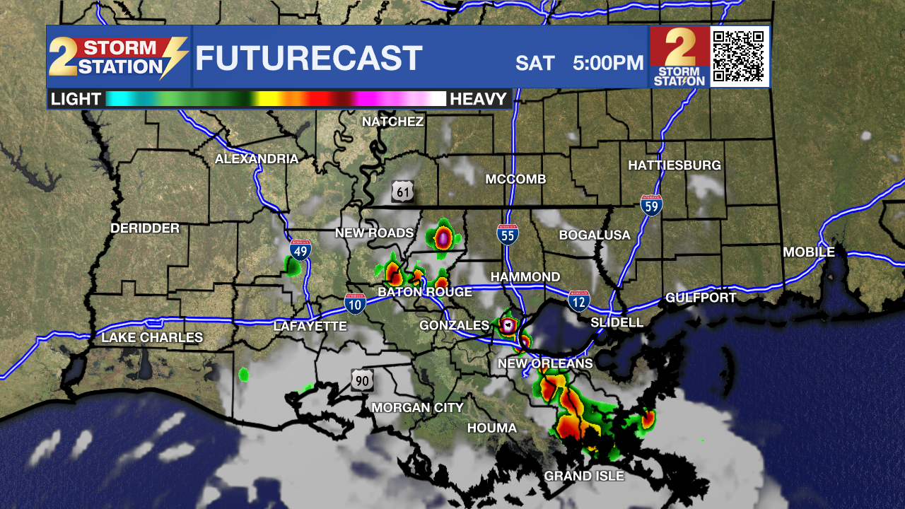
Today & Tonight: The pattern is setting the stage for another extremely hot week, and that begins today with high temperatures soaring to the upper 90s with the heat index easily pushing to the low 100s. Any relief from the heat will come in the form of afternoon showers and thunderstorms as the stalled boundary sitting down along the LA gulf coast will being to move north and provide the focus for this activity. It is reasonable to expect that some of these storms may push to severe limits with heavy rain, dangerous lightning, gusty winds and small hail. Overnight should be much quieter with clear skies and calm conditions.
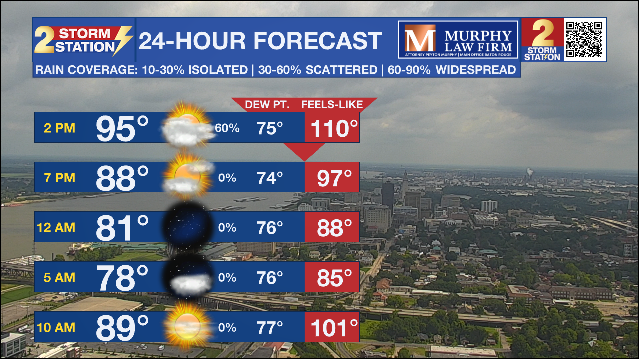

Up Next: All told this will be the second occurrence of excessive heat within a two week span and things are in place to get very hot very quick over the next several days. There are no heat advisories at the moment, but excessive heat criteria will likely be met on Sunday and definitely over the next several days as daytime high temperatures will hit the century mark and the heat index could reach anywhere from 110 to 120 degrees, and that folks is an extremely dangerous situation. As always, use good judgement when outdoors and spending abundant time in the elements.
The Storm Station has you covered with hour-by-hour weather tracking is available for your location on the WBRZ WX App on your Apple or Android device. Follow WBRZ Weather on Facebook and Twitter for even more weather updates and unique weather insight from the whole team!
Trending News
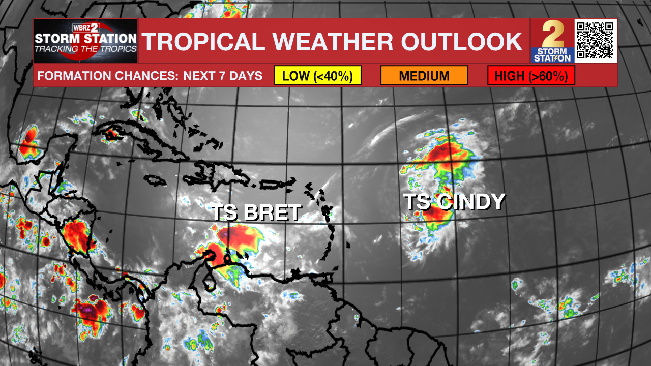
In the Tropics: Tropical Storm Bret is expected to continue weakening over the course of the weekend. The storm is moving west at 14mph with maximum sustained winds of 65mph. Bret will quickly weaken and eventually dissipation over the Caribbean Sea this weekend in the face of harsh wind shear.
Tropical Storm Cindy has formed in the eastern Atlantic. That system will continue northwestward remaining north and east of the Lesser Antilles over the weekend. Cindy now was maximum sustained winds at 50mph and is moving west-northwest at 16mph. Tropical Storm Cindy will not be a threat to the local viewing area.
Get the latest 7-day forecast and real time weather updates HERE.
Watch live news HERE.
--Keller
The Storm Station is here for you, on every platform. Your weather updates can be found on News 2, wbrz.com, and the WBRZ WX App on your Apple or Android device. Follow WBRZ Weather on Facebook and Twitter for even more weather updates while you are on the go.
More News
