

Latest Weather Blog
Midweek sun before late week showers
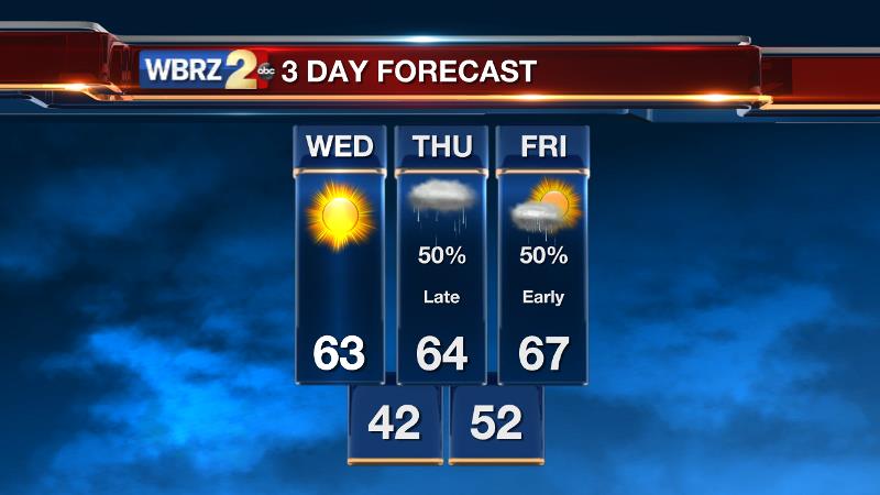
Enjoy sunshine for the third straight day this work week before showers return to region.
THE FORECAST:
Today and Tonight: Wednesday will show the region one more dry and sunny day. A gradual warming trend will continue with highs stretching for the mid 60s. Overnight, increasing clouds late will result in lows staying up a bit—in the low to mid 40s.
Up Next: By Thursday, skies will show an increase in cloud cover with rain arriving through the afternoon from southwest to northeast. Highs will stop in the mid 60s on account of reduced sunshine. A batch of rain will swash across the region into Friday Morning with lows in the low 50s. By the afternoon, some clearing is expected with a high in the mid 60s.
Trending News
THE SCIENCE:
Forecast Discussion: A dry atmosphere and subsidence resulting from a surface high over the Gulf South will keep ample sunshine and zero threat for rain through Wednesday. For struggling early, forecast models have come into very nice agreement with regard to the next several, fast-moving storm systems. On Thursday a shortwave trough sliding over the baroclinic Texas Gulf Coast will help to develop a surface low pressure system. This low will track east-northeastward along the Gulf Coast spreading a shield of rain. With clouds increasing through the day, rain is then pegged to begin as early as midday for southern spots, spreading into the I-10/12 corridor by late afternoon. Showers will linger overnight into the first half of Friday. Temperatures won’t be modified much by this system. A second shortwave will spin through the region Saturday Evening with little moisture to churn out a widespread rain event. We’ll mention scattered showers—primarily after dusk Saturday. This go around, a cold front is expected with winds turning northerly and cold air advection kicking in once again on Sunday. Highs and lows will run about 5° below average for the second half of the weekend with a mix of sun and clouds. The third wave is timing out for Monday Night—again with limited moisture.
--Josh
Stay connected with me… share your thoughts!
Twitter: @Josh_Eachus
Google+: Josh Eachus
Facebook: Meteorologist Josh Eachus
More News
