

Latest Weather Blog
Sunday Evening Video Forecast
Related Story
A quieter night is ahead after a relatively “bumpy” Sunday afternoon full of storms. While the overall rain coverage may end up a tad lower on Monday, Mother Nature will attempt a repeat performance of the stormy action.
Tonight & Tomorrow: Expect afternoon thunderstorms to quickly fizzle throughout the evening. Clouds will linger in their wake, but even those will gradually clear with time, so have sunglasses ready for the Monday morning drive. It will be another mild start in the low to mid-70s. Early sun will rapidly push temperatures up, eventually rising into the low 90s by afternoon. The atmosphere will remain warm and loaded with moisture, supporting a round of scattered afternoon thunderstorms. A handful of these storms could produce 40 to 60 mph wind gusts and locally heavy rainfall. All thunderstorms will be capable of frequent lightning. Expect these summer storms to die down after dark.

Use the slider to advance through the next 24 hours of Futurecast
Up Next: This routine of heat and humidity driving a fresh crop of afternoon storms will continue through the week, though daily coverage will gradually diminish. Scattered storms on Tuesday will become much more isolated by the end of the week. As that happens, afternoon highs will trend warmer toward the mid-90s. Next weekend, the pattern will flip again as another moisture surge fuels a greater number of afternoon storms.

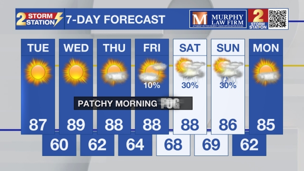
Get the latest 7-day forecast and real-time weather updates HERE.
Watch live news HERE.
The Tropics: The Atlantic Basin remains quiet. The National Hurricane Center is not expecting tropical cyclone development anywhere in the Atlantic, Caribbean, or Gulf over the next seven days.
— Meteorologist Malcolm Byron
The Storm Station is here for you, on every platform. Your weather updates can be found on News 2, wbrz.com, and the WBRZ WX App on your Apple or Android device. Follow WBRZ Weather on Facebook and X for even more weather updates while you are on the go.
News

