

Latest Weather Blog
Monday night video forecast
Related Story
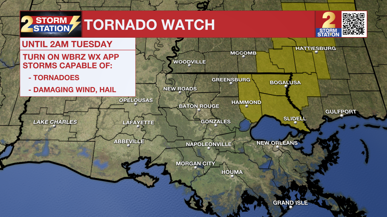
1:00 AM UPDATE: Baton Rouge and surrounding areas have been removed from the Tornado Watch. Tangipahoa Parish remains under the Watch until 2 a.m. Tuesday. That said, storms maintained a rather innocent appearance on radar with the latest scans. More seems to be going against any tornado development, so it suffices to say that the severe weather risk is very slim through the rest of the night.
Remember that the WBRZ WX App. is *free* on Apple and Android devices and can be used for breaking weather information, live radar, and forecast details. You can also use it to watch live coverage if power or broadcast signal is ever lost. For even more, connect with the Storm Station on Twitter and Facebook. Stream WBRZ+ for continuous information as it becomes available.
Click HERE to watch WBRZ streaming live online
Click HERE for the WBRZ weather page.
Click HERE to see how to download the WBRZ weather app.
Posts below are from the WBRZ Weather X account. Monitor for weather warnings below.
Tonight & Tomorrow: Scattered precipitation is expected to continue ahead of a stronger line of showers and thunderstorms that will pass through tonight. Expect the line moving into communities west of the Mississippi River as early as 6pm and exit east of I-55 by 3am. The middle of that timeframe, about 10pm - 1am, will be the most active period in the Baton Rouge area.
?? Curious what goes into determining the "severe weather risk" for a given event? Chief Meteorologist @DrJoshWX shares the latest outlook and explains the setup for this round.
— WBRZ Weather (@WBRZweather) March 25, 2024
Full Forecast --> https://t.co/L1HG17J8HF pic.twitter.com/vn08bTiSoh
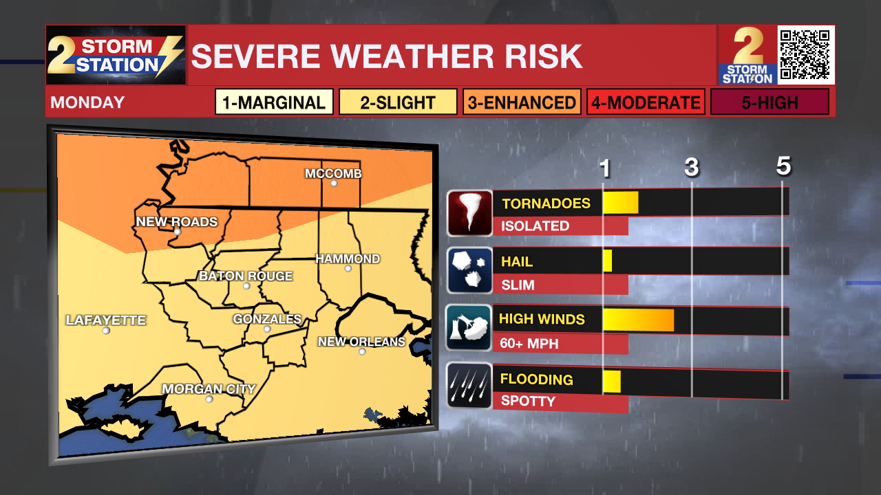
The Storm Prediction Center has placed areas north of Baton Rouge under a Level 3/5 risk for severe weather where a slightly greater coverage of severe weather is possible. Baton Rouge remains under a Level 2/5 severe weather risk, where more isolated instances of severe weather are possible. Damaging straight-line winds is the primary concern, although isolated tornadoes can’t be ruled out either. It will be important to have a way to receive weather alerts in case you find yourself under any warnings. You can download the free WBRZ Weather App to help stay ahead of the storm HERE.
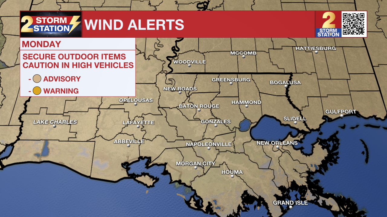
It will also be noticeably windy, even outside of storms. Expect sustained winds upwards of 30mph with gusts pushing 40mph. A Wind Advisory is in effect across much of southern Louisiana into Tuesday morning. The last of the showers and thunderstorm will end before dawn on as low temperatures eventually settle into the low 60s. Tuesday will mark the beginning of an extended dry stretch with sunshine quickly returning to the region. Thermometers will claw back into the upper 70s, even as a cold front pushes east of the area. Any brief spell of humidity noted at the beginning of the week will be long gone by afternoon.
Up Next: A very quiet weather pattern will take hold Wednesday and beyond. For the remainder of the workweek, lows will be in the upper 40s and highs will gradually warm from the mid to upper 70s each day. Expect ample sunshine. Little will change moving into Easter Weekend. We may start to notice a few more clouds during the afternoon hours in response to a continued warming trend. Highs will move into the 80s both Saturday and Sunday.
Get the latest 7-day forecast and real time weather updates HERE.
Watch live news HERE.
The Storm Station is here for you, on every platform. Your weather updates can be found on News 2, wbrz.com, and the WBRZ WX App on your Apple or Android device. Follow WBRZ Weather on Facebook and Twitter for even more weather updates while you are on the go.
News
