

Latest Weather Blog
Weather pattern stalls, above average temps to continue
Our short-lived fall preview from the weekend is long gone. Tropical Storm Epsilon is leaving us alone, but it is also plugging up the pattern and keeping any significantly cooler air far from the Gulf Coast. After this hurricane season, I guess that is a tradeoff we can accept.
The Next 24 Hours: The prospects for fog will be a little lower tonight though it will not be impossible for a few patches to form. Otherwise, expect mostly clear skies and lows in the upper 60s. Wednesday will run repeat weather with highs in the upper 80s beneath mainly sunny skies. There is an outside shot for a coastal shower.
After That: By Thursday afternoon, a weak upper level disturbance moving in from the west may bring an isolated shower. Then on Friday, a weak cold front will push into the area and grab some Gulf moisture to put out scattered showers and thunderstorms. While the front will not change temperatures or humidity much, the two disturbances and the front will depart for lower rain chances once again over the weekend. If you are looking for cooler air, next Tuesday or Wednesday seems to be the earliest possibility.
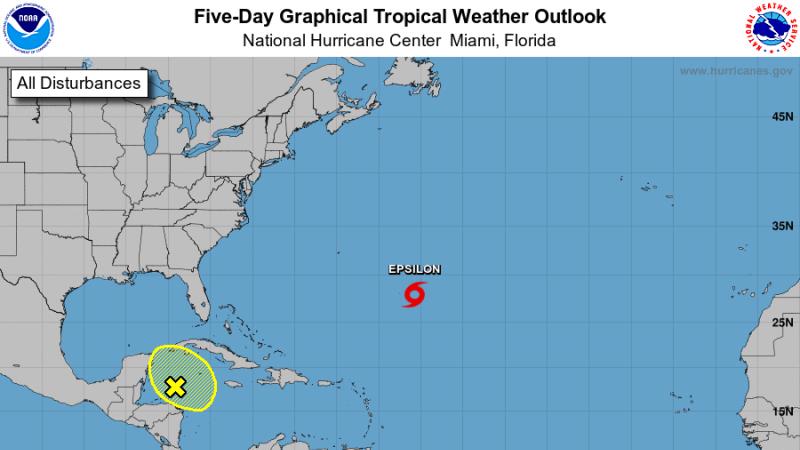
The Tropics: As of 4pm Tuesday Tropical Storm Epsilon was to the southeast of Bermuda moving northwest at 10-15 with maximum sustained winds of 65mph. A gradual turn to the north will accelerate by the end of the week and Epsilon is forecast to pass east of Bermuda as a hurricane on Thursday. It will move out to sea from there.
Trending News
A trough of low pressure has formed over the western Caribbean Sea, which extends northward across western Cuba. The associated shower and thunderstorm activity is located along the northern portion of the trough axis where upper-level winds are not conducive for significant development so formation chances are just at 10 percent over the next 5 days.
The Explanation: A weak upper level trough advancing from west to east across the southern third of the country will try to stir up isolated to scattered showers and thunderstorms Thursday and Friday. Neither day will bring substantial coverage or amounts. Friday is the more likely to see showers but even then, about half of the area should stay dry. Well above average temperatures will continue through the middle of the week and even as showers enter the forecast Thursday and Friday, the numbers will only fall by a few degrees and stay above normal. As the two aforementioned disturbances fall apart by the weekend, expect drier conditions. A cold front may finally enter the area by about Tuesday of next week with some showers and thunderstorms followed by a marked cool down. Since this is beyond the 7-Day Forecast, there is still plenty of time to hammer out timing and strength details.
--Josh
The WBRZ Weather Team is here for you, on every platform. Your weather updates can be found on News 2, wbrz.com, and the WBRZ WX App on your Apple or Android device. Follow WBRZ Weather on Facebook and Twitter for even more weather updates while you are on the go.
More News
