

Latest Weather Blog
Saturday AM forecast: On and off rain likely for the holiday weekend
Moisture remains locked in across south Louisiana heading into Saturday, keeping scattered showers and thunderstorms in the forecast for Baton Rouge and surrounding communities. While rain coverage is expected to be widespread, any storm that develops will still be capable of producing torrential rainfall and localized street flooding.

Today and tonight: Saturday will feature another warm and humid start with temperatures climbing into the mid-80s by the afternoon. Scattered showers and thunderstorms are expected to develop during the morning and afternoon hours. Storms are expected to remain disorganized overall, but the tropical atmosphere in place will allow for very heavy rainfall in short periods of time.

Use the slider to advance through the next 24 hours of Futurecast
Trending News
Rainfall rates of 2 to 4 inches per hour will once again be possible in the strongest storms. Some neighborhoods could quickly see water ponding on roads or localized flooding issues if storms repeatedly move over the same location. Activity should gradually diminish later Saturday evening, although warm and muggy conditions will continue overnight with lows staying in the lower 70s.
Up Next: The unsettled pattern is expected to continue through much of next week as a slow-moving upper-level trough remains parked across the southern United States. Daily rounds of scattered showers and thunderstorms are expected Sunday through at least Thursday, with additional heavy rainfall possible each day.
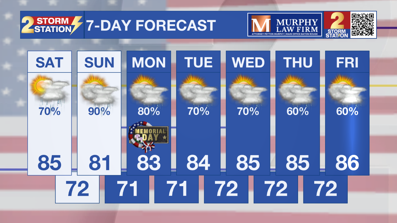
Rain totals over the next 7 days could range from 4 to 7 inches across parts of inland southeast Louisiana and southwest Mississippi, including portions of the Baton Rouge area. Localized higher totals are possible where storms repeatedly develop.
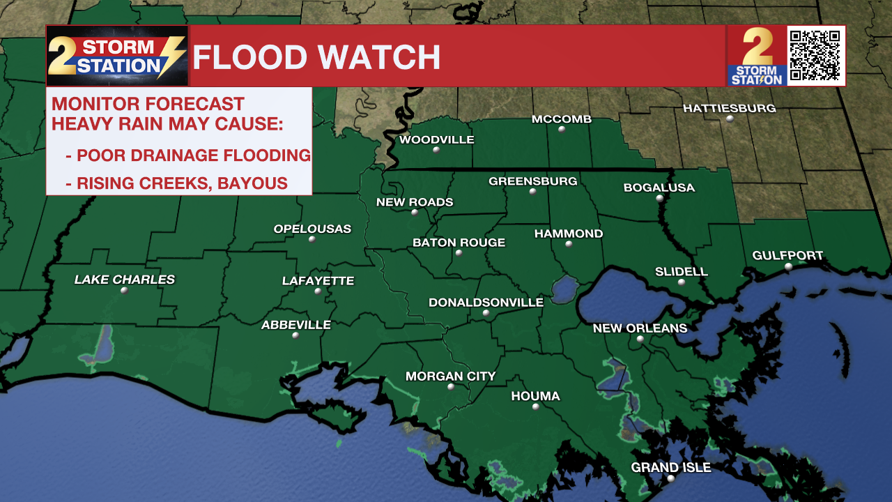
What to look out for: The biggest concern continues to be localized flooding from slow-moving storms capable of producing torrential rainfall. While widespread flooding is not expected at this time, saturated ground and repeated rounds of rain could quickly create problems in poor drainage and low-lying areas around Baton Rouge. Conditions will also stay very warm and humid, with overnight temperatures struggling to cool below the lower 70s.
Get the latest 7-day forecast and real-time weather updates HERE.
Watch live news HERE.
– Dave
The Storm Station is here for you, on every platform. Your weather updates can be found on News 2, wbrz.com, and the WBRZ WX App on your Apple or Android device. Follow WBRZ Weather on Facebook and X for even more weather updates while you are on the go.
More News
