

Latest Weather Blog
Saturday PM forecast: Extreme heat before rainfall returns next week
Dangerous heat will remain the biggest weather story through the weekend as heat index values climb to around 108 degrees each afternoon. Rain chances stay low for now, but a much wetter pattern is expected to return by the middle of next week.

Tonight and Sunday: A warm and muggy night is ahead with lows only falling into the middle 70s. Most neighborhoods will stay dry, although an isolated shower or thunderstorm can't be ruled out. The bigger weather story arrives Sunday as dangerous heat builds across the region. Heat index values will climb to around 105 to 108 degrees during the afternoon, and additional Heat Advisories may be needed.

Use the slider to advance through the next 24 hours of Futurecast
Up Next: An easterly wave will move into the Gulf Coast beginning Tuesday night and into Wednesday. That system will bring showers and thunderstorms capable of producing heavy rainfall, and a few strong to severe storms with damaging wind gusts. The added clouds and rain should knock temperatures back into the upper 80s and lower 90s by Wednesday.
Trending News
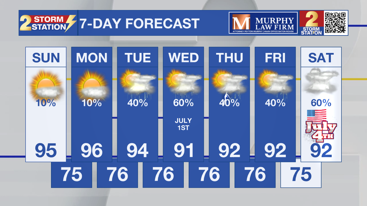
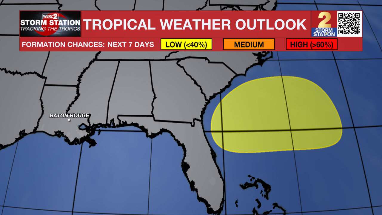
Tropics: Forecasters are monitoring an area that could develop off the Southeast U.S. coast early next week, but development chances remain low at only 20% over the next seven days, and no impacts to Louisiana are expected at this time.
Get the latest 7-day forecast and real-time weather updates HERE.
Watch live news HERE.
– Dave
The Storm Station is here for you, on every platform. Your weather updates can be found on News 2, wbrz.com, and the WBRZ WX App on your Apple or Android device. Follow WBRZ Weather on Facebook and X for even more weather updates while you are on the go.
More News
