

Latest Weather Blog
Sunday AM Forecast: A Much Less Warm Day as the Dry Streak Continues
A few less humid and less warm days to look forward to as the dry streak continues
THE FORECAST
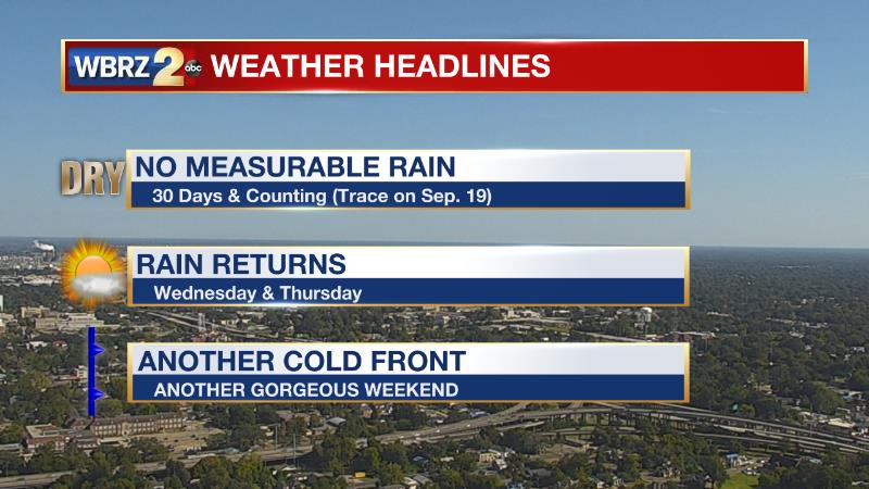
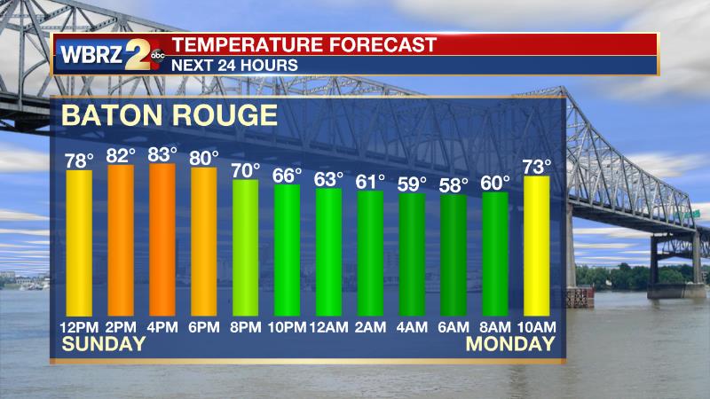
Today & Tonight: Expect a much more comfortable day with lower humidity and high temperatures only reaching into the lower 80s. Copius amounts of cooler and drier air has been ushered in by the passing cold front, and that has been responsible for the comfortable feeling conditions and keeping the humidity in check. The north wind will continue to lend a hand in keeping these comfortable conditions entrenched for the next few days through at least Tuesday. Overnight lows will dip into the middle to upper 50s and bring a welcoming chill to the early morning air. The streak of no measurable rain is up to day number 30 with only a trace noted on Sept 19th.
Up Next: Monday will start much cooler with temps lingering in the 50s with plenty of sunshine and cobalt blue skies with very few clouds to be found. Dew points will remain low and much cooler temperatures will be responsible for the pleasant feel. High temperatures will continue to be seasonable in the low-80s. Into the evening hours temperatures will cool back into the mid-50s. The cooler trend will be sticking around for the start of your workweek. Waking up with temperatures in the 50s and day time highs heating into the mid-to-low 80s. Rain stays out of the forecast until later in the workweek. Click here to see the 7-day forecast.
Trending News
The Storm Station has you covered with hour-by-hour weather tracking is available for your location on the WBRZ WX App on your Apple or Android device. Follow WBRZ Weather on Facebook and Twitter for even more weather updates and unique weather insight from the whole team!
In the Tropics:
https://dcer237tfveol.cloudfront.net/img/wbrz/files/1009f.jpg
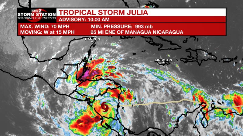
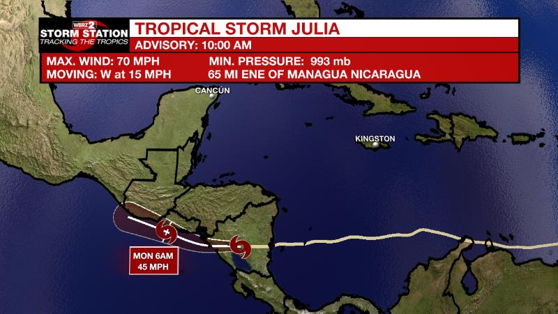
As of 10am Sunday, Tropical Storm Julia has made landfall on the Nicaraguan east coast as of early Sunday morning, and continues moving west across Nicaragua Central America at 15mph with maximum sustained winds of 70 mph which are near hurricane force. Due to the higher terrain there, significant flooding will be the primary threat. T.S. Julia will exit the western coast of Nicaragua later today and continue tracking west inot the Pacific Ocean with no threat to the U.S. mainland.
More News
