

Latest Weather Blog
Sunday a bit more active, summertime pattern well into next week
There will not be much disruption to the summertime weather pattern in place for the Baton Rouge area. Of the two weekend days, Sunday looks to be a bit more active.
Next 24 Hours: Overnight will be partly cloudy with low temperatures in the mid 70s. The same summertime pattern is expected to begin the weekend as partial sunshine guides high temperatures into the low 90s before a few showers and thunderstorms pop. Any will be capable of brief downpours and frequent lightning.
Up Next: A slight uptick in showers and thunderstorms is figured into the forecast by Sunday thanks to a weak upper level disturbance moving across the Gulf Coast. In fact, the daily rhythm could be disrupted a bit as some morning showers and thunderstorms will be in the mix as well afternoon activity. The day will not be a total washout but keep your favorite weather app. handy, as lightning will be a periodic threat. Afternoon action will be “scattered” through at least Monday. Really, with no sign of dew point temperatures (humidity) falling and the atmosphere remaining slightly cooler and more unstable than average, rain chances will stay on the board. CLICK HERE for your full 7-Day Forecast.
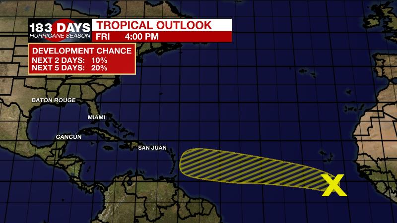
The Tropics: Disorganized showers and thunderstorms over the far eastern Atlantic are associated with a strong tropical wave. Development, if any, of this system should be slow to occur during the next several days due to marginally conducive environmental conditions. This wave is given a 20 percent chance of formation as it moves west-northwestward at 15 to 20 mph across the eastern and central Atlantic through the middle of next week.
Trending News
For the latest forecast and preparation reminders, visit the WBRZ Hurricane Center as we navigate all 183 Days of Hurricane Season.
The Explanation: The surface high pressure system, known as the “Bermuda High” this time of year, will allow a southeast to northwest moving sea breeze to spark off daily showers and thunderstorms during the late morning hours. As we have felt with dew point temperatures in the mid to upper 70s, there has been no shortage of moisture in the atmosphere and as sunshine warms temperatures to the upper 80s and low 90s, all of these factors combine to produce convection. There are some signs that moisture could drop just a touch Saturday leading to a few less showers, but it will not dry out enough to shut down activity. An inverted upper level trough of low pressure will scoot across the Gulf of Mexico Sunday and this feature will trigger scattered to widespread showers and thunderstorms—likely the busiest day of the extended forecast. Actually, Sunday is the one day that may be an exception to the traditional timing and some morning activity is possible too. While the center of the trough will move west of the local area by Monday, the upper levels will remain a bit cooler and more unstable than usual allowing for near to above average areal coverage of showers and thunderstorms well through next week. As a result, high temperatures will remain just a few clicks shy of average.
--Josh
The WBRZ Weather Team is here for you, on every platform. Your weather updates can be found on News 2, wbrz.com, and the WBRZ WX App on your Apple or Android device. Follow WBRZ Weather on Facebook and Twitter for even more weather updates while you are on the go.
More News
